Dynamic Masking Effect, Satellite Scanning Transit Orbit Satellite Situation Awareness Simulation: FUTURE ELEMENTS TECHNOLOGY PTE is an innovative GIS platform software and service provider,Innovate IT Value with Geo-intelligence.The three-dimensional electronic sand table big data visual geographic information system(FUTURE 3D GIS) is a large-scale two- and three-dimensional integrated geographic information system independently developed by FUTURE ELEMENTS TECHNOLOGY PTE through gesture multi-touch control.
Satellite Situation Awareness Simulation: Dynamic Masking, Orbital Visualization & Multi-Layer Data Interaction in 3D Space
Satellite Situation Awareness Simulation:
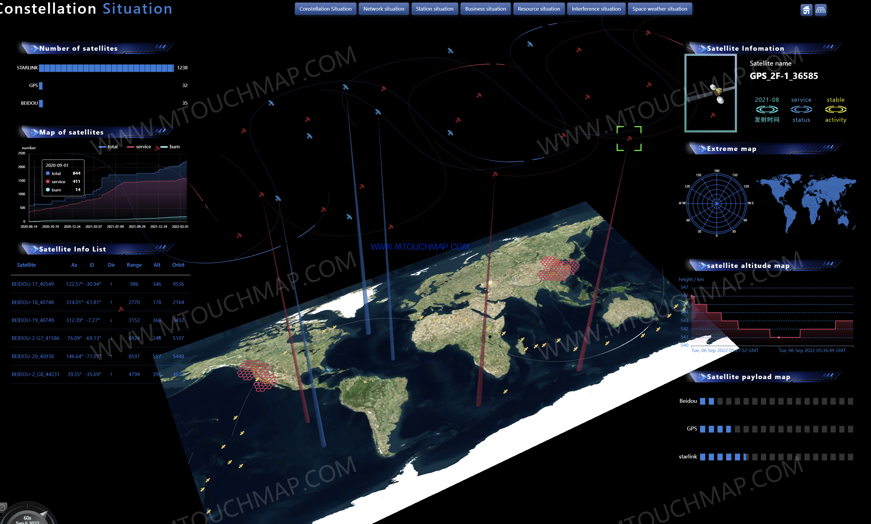
Load CZML files to display global satellites
Display a hexagonal ground grid
Click on a satellite to show its circular trajectory and conical scanning beam
Display detailed information of each satellite in charts (upon clicking)
Track the perspective of a single satellite (double-click)
Connect multiple satellites to show their relationships
Link satellites with ground stations to display associations
Use a progress bar to control and view the situation at specific times
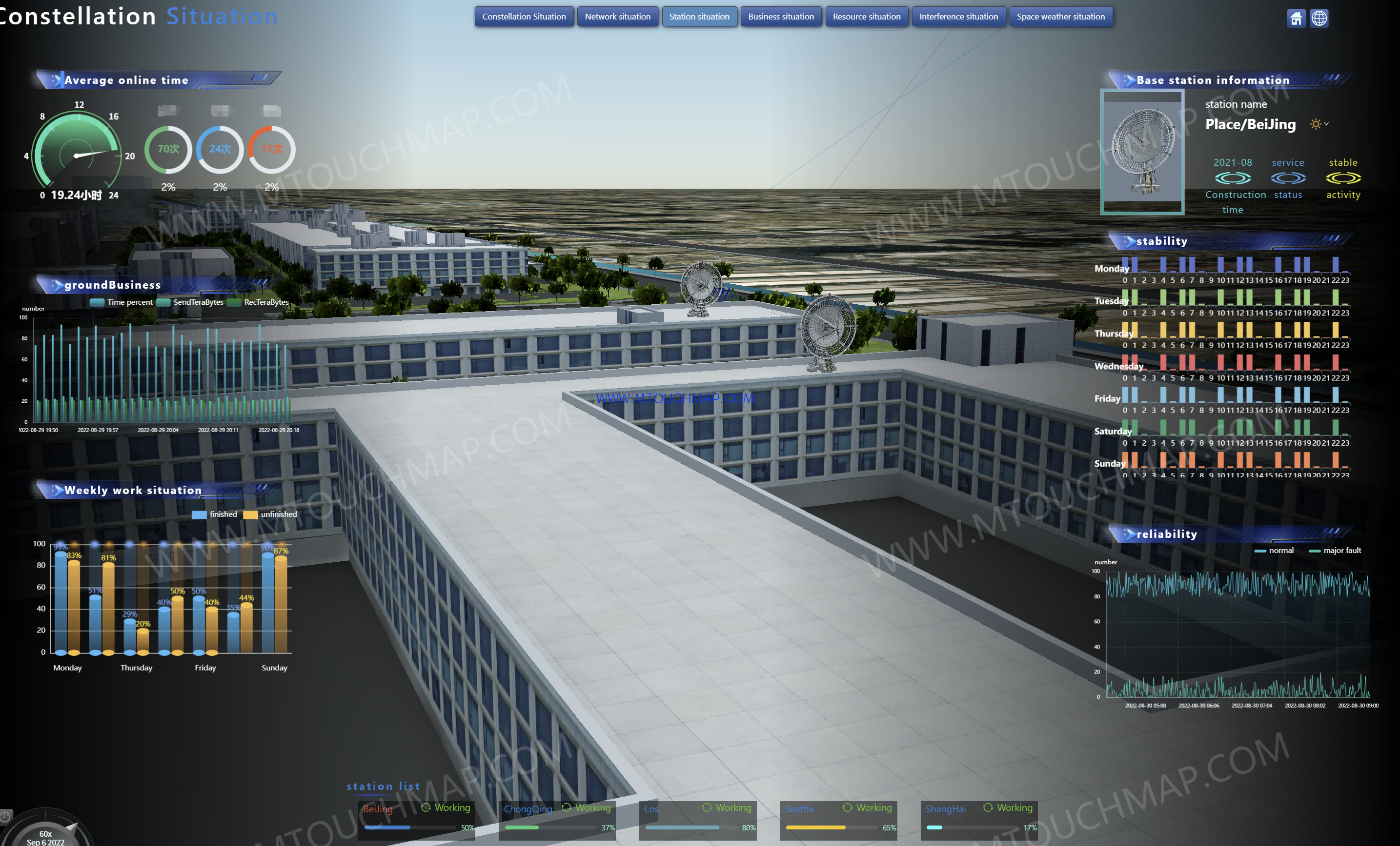
View the 3D situation of ground stations
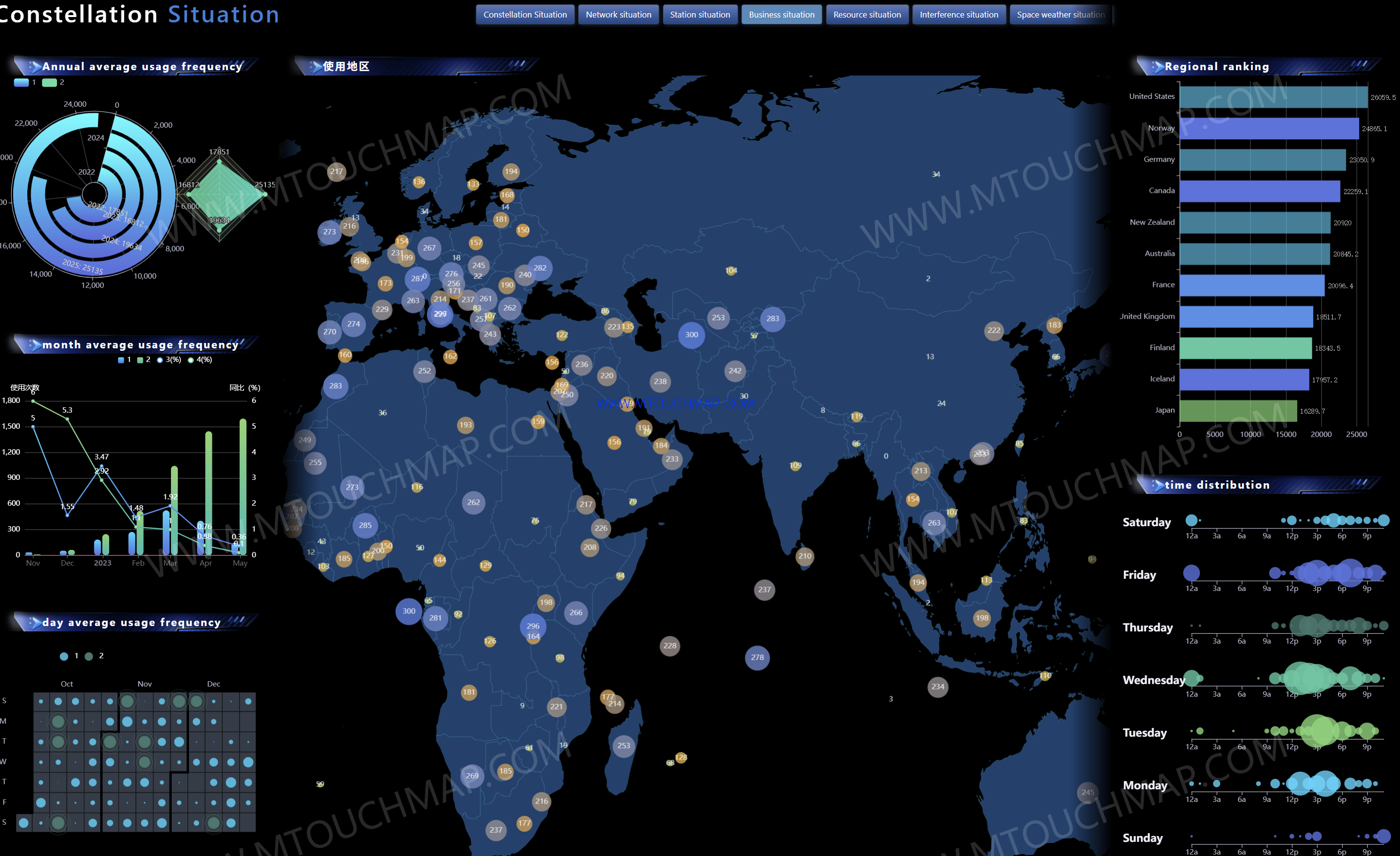
View the resource situation dashboard
View the operational situation dashboard