


Discover how the FUTURE AI 3D GIS platform connects real time API data with a powerful 3D digital twin environment for smarter city monitoring and command centre operations.
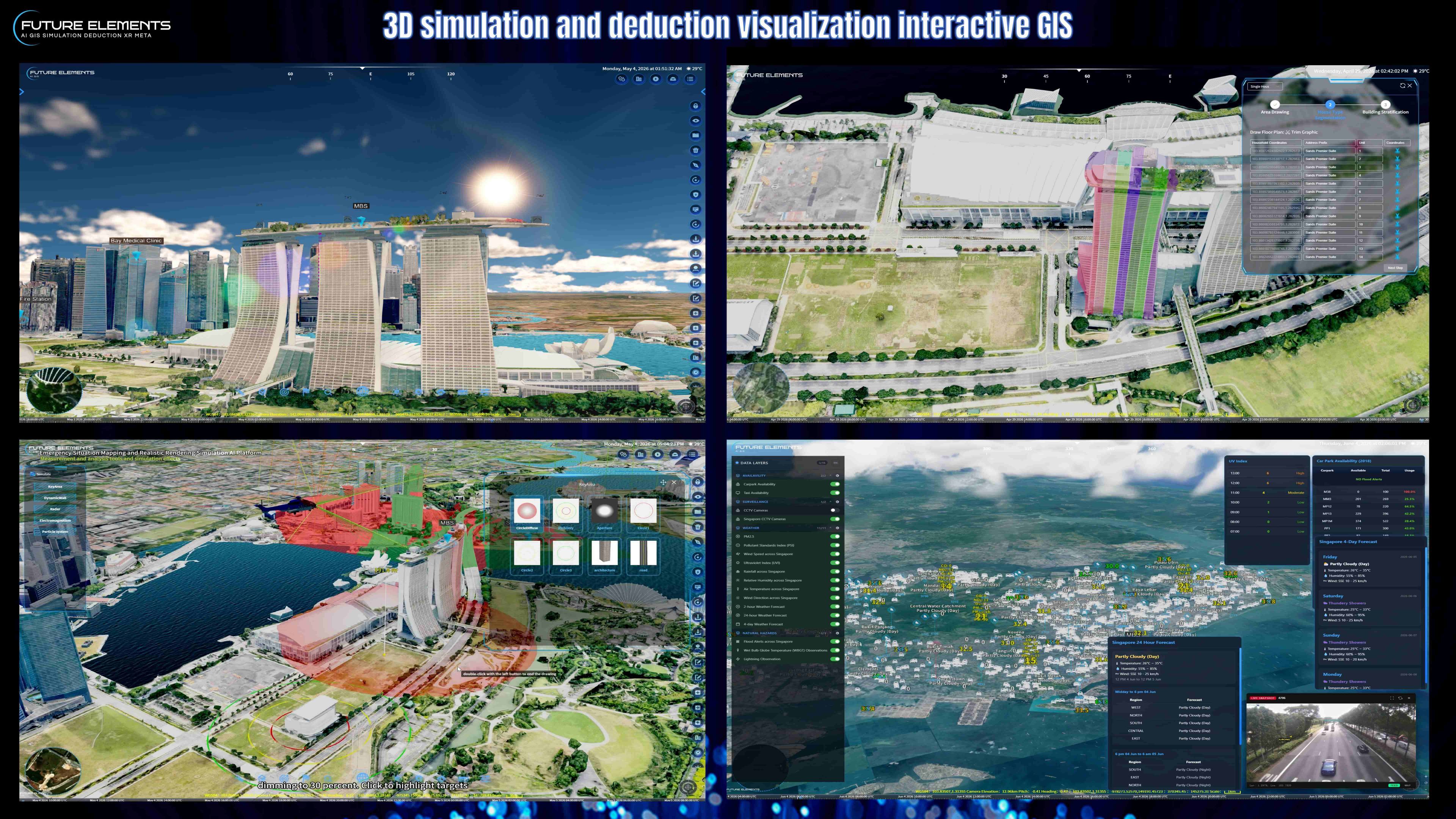
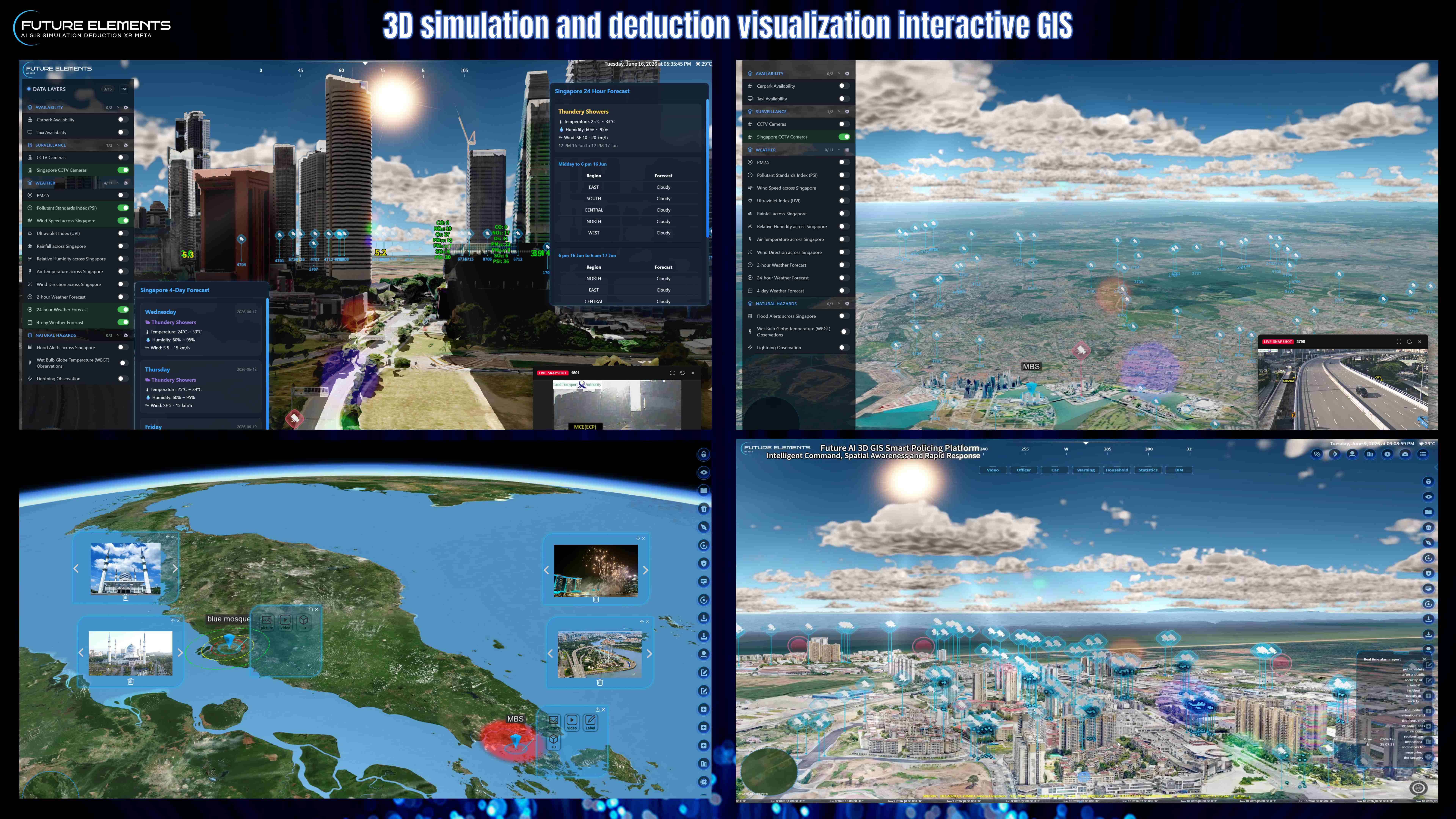
In this demo, the platform showcases multi source data fusion, dynamic API parsing, and real time map visualization for Singapore and selected global data sources. With just a few clicks, users can access live operational insights directly on the 3D GIS map.
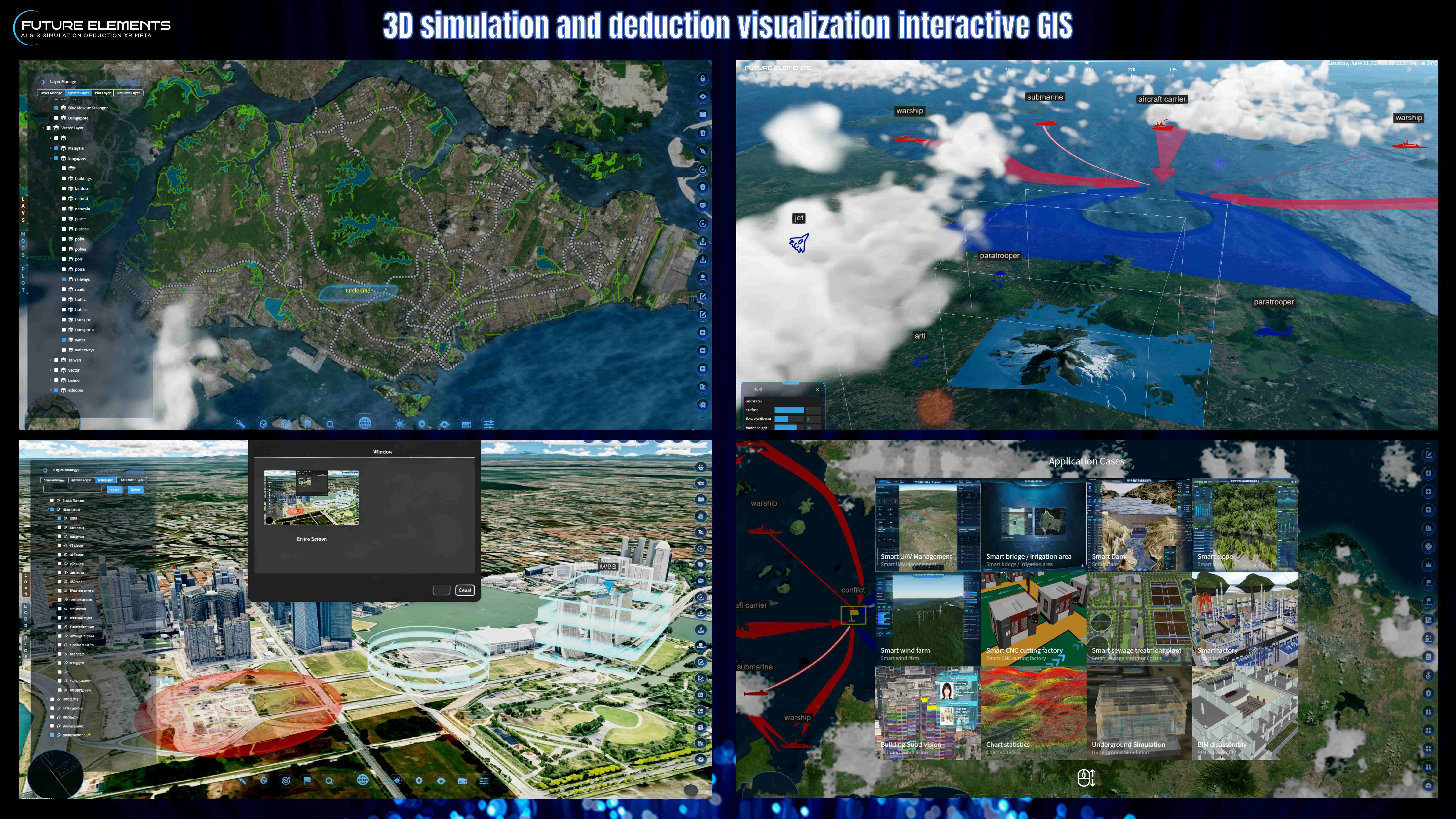
Discover how FUTURE AI 3DGIS uses artificial intelligence to control 3D GIS scenes through voice and text commands. This demo showcases real time multilingual speech recognition, natural language understanding, and automated 3D GIS execution for location search, landmark labeling, measurement, mapping, navigation, spatial analysis, and interactive visualization. In this video, FUTURE AI 3DGIS demonstrates how users can ask the system to fly to landmarks such as Marina Bay Sands, search nearby cafes, highlight buildings within a 500 meter radius, measure Gardens by the Bay, create emergency isolation zones, generate no fly zones, measure mountain height and area, create flight routes, calculate airport distances, import vector data, and identify mountain peaks using terrain elevation data.
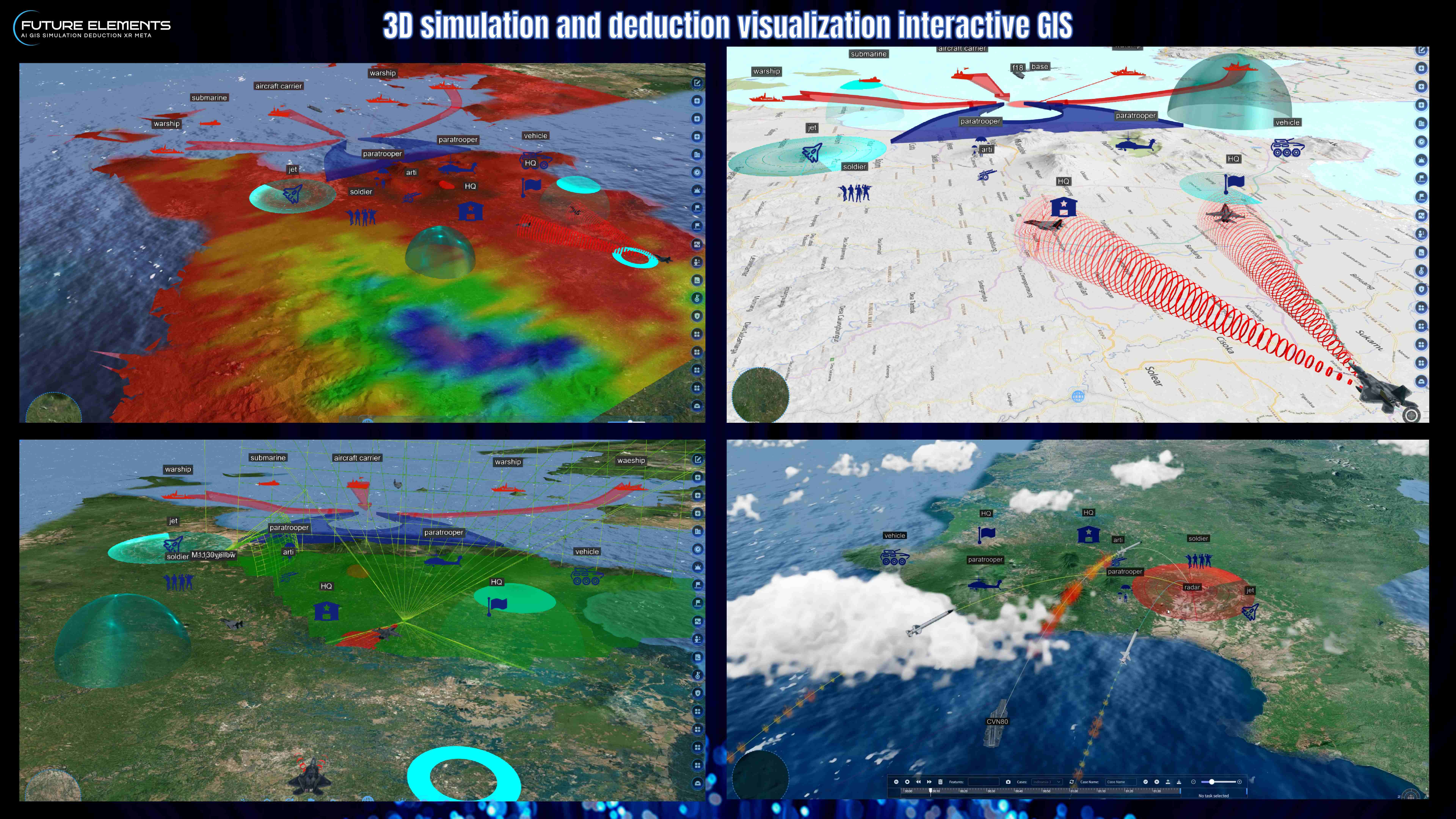
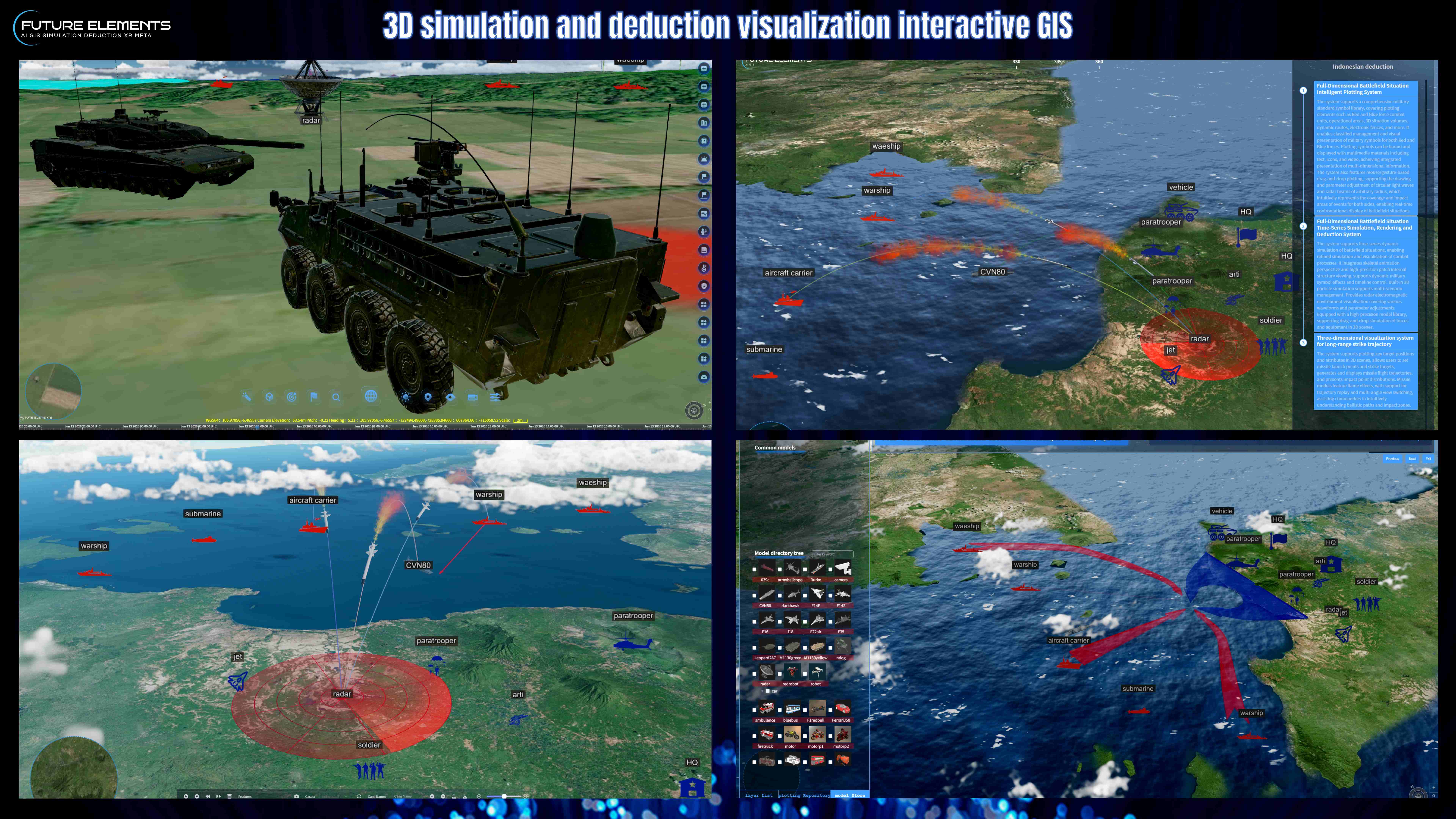
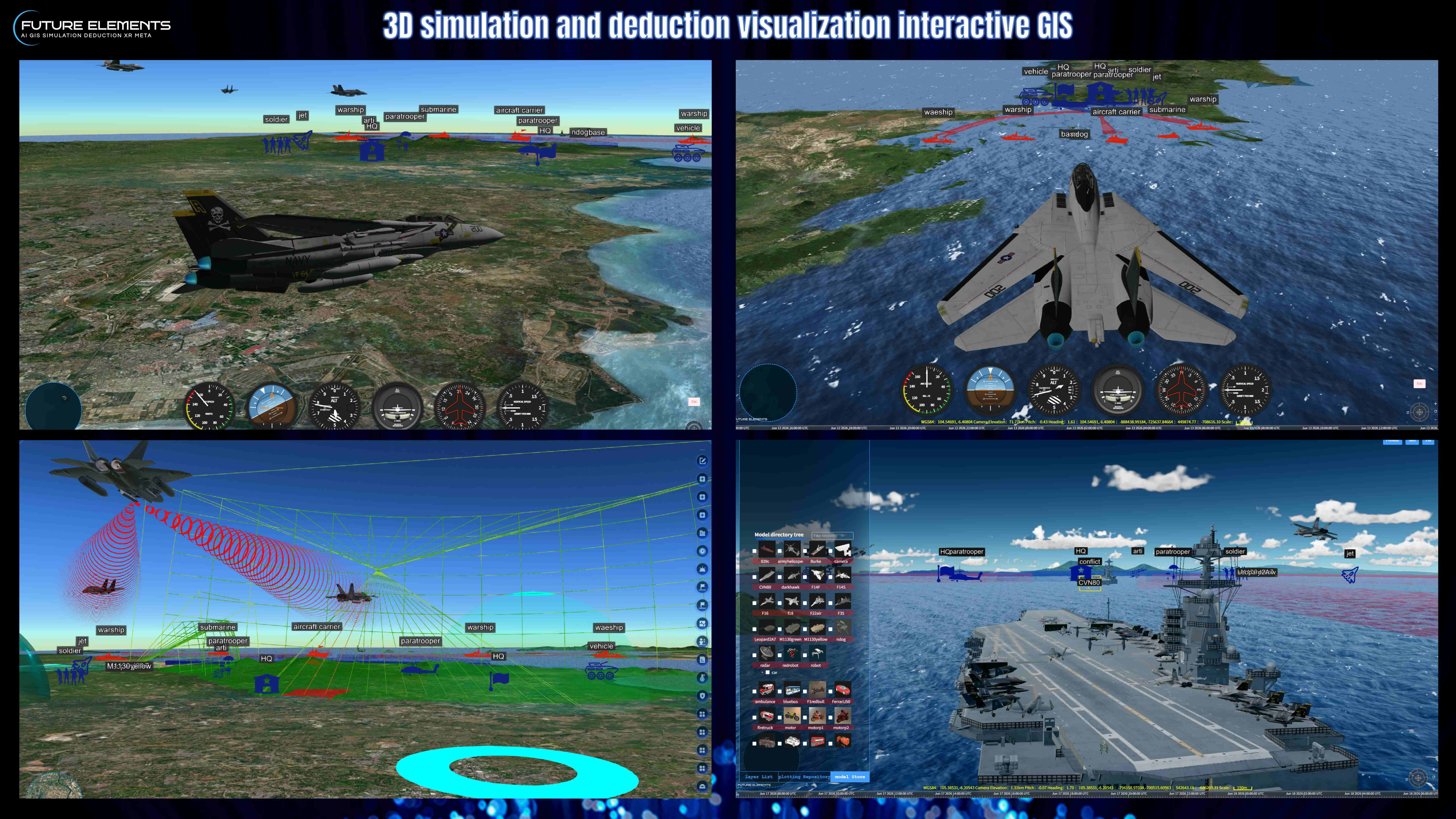
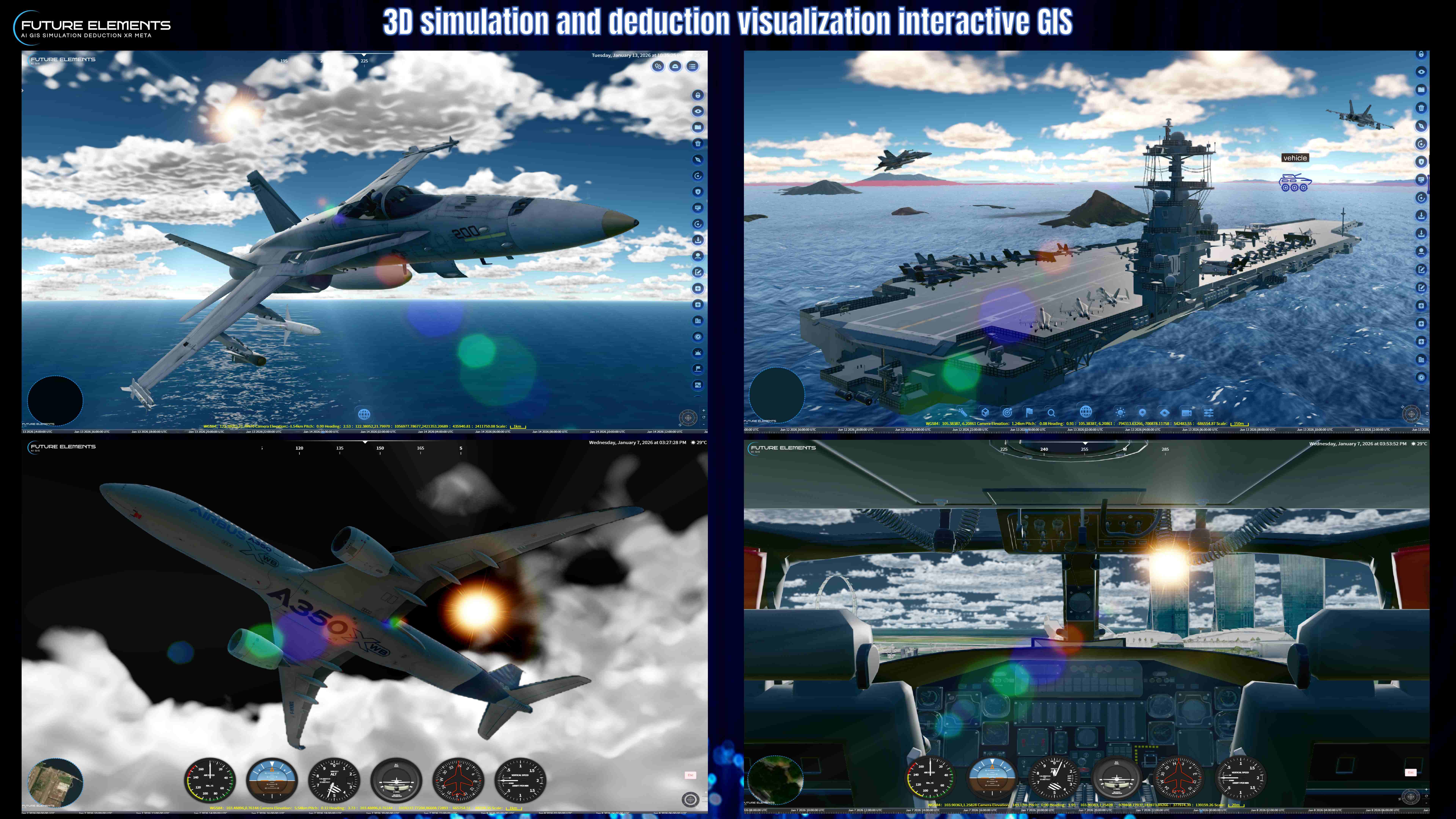
This AI powered 3D GIS platform is designed for smart city operations, urban planning, tourism guidance, geography education, security drills, emergency response, aviation route visualization, and digital twin command centre applications. Key features shown in this demo: AI voice command for 3D GIS Multilingual real time speech recognition Natural language spatial understanding Automated 3D map navigation POI search and landmark labeling Buffer zone and area measurement 3D emergency zone creation No fly zone visualization Mountain peak identification Airport route and distance analysis Vector data mapping and labelling Smart city digital twin visualization FUTURE AI 3DGIS brings together artificial intelligence, 3D geographic information systems, digital twin visualization, and spatial analysis to make complex geospatial operations faster, smarter, and easier to use. By Future Elements Technology ( Singapore
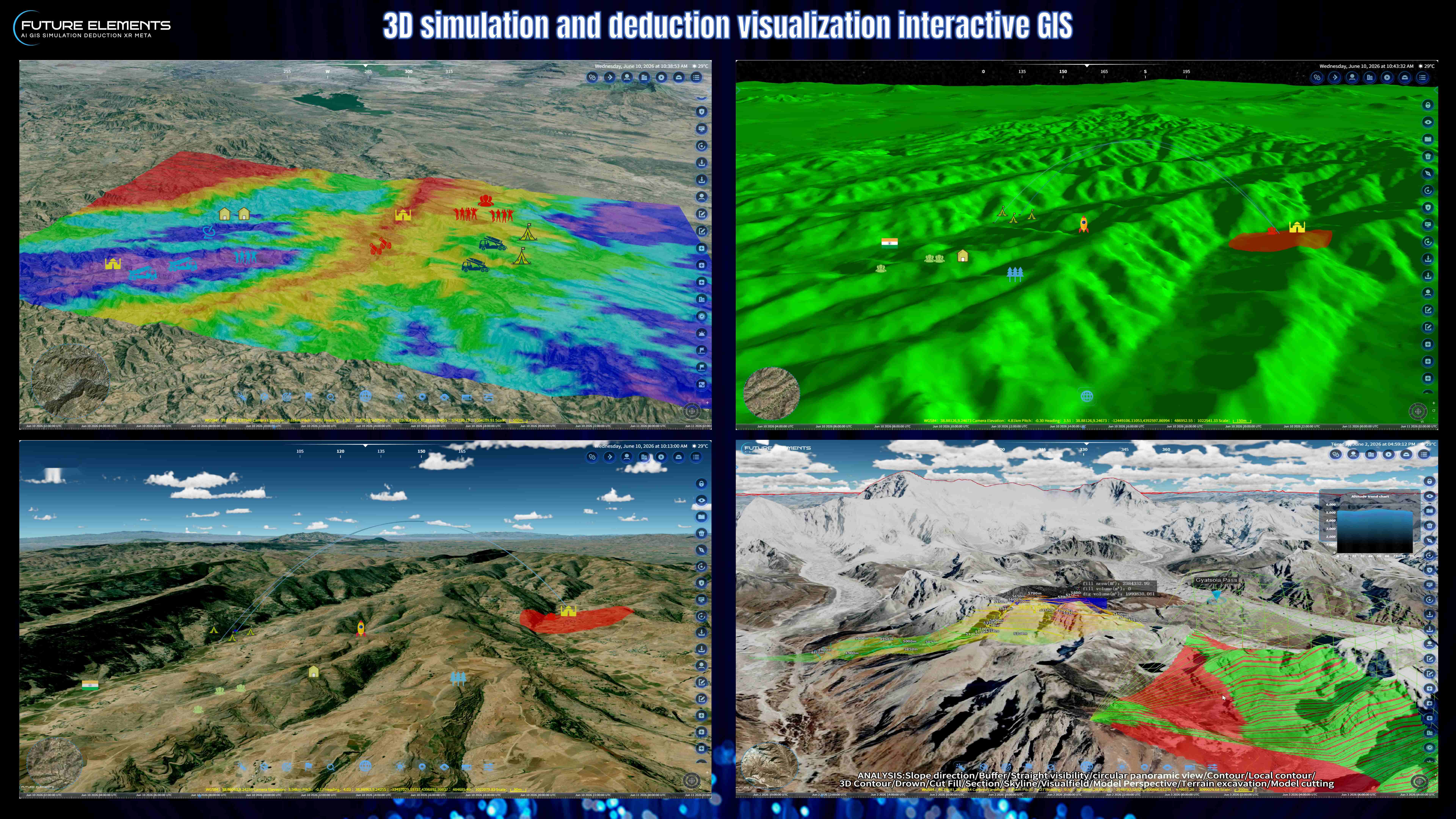


Discover how FUTURE AI 3DGIS uses artificial intelligence to control 3D GIS scenes through voice and text commands. This demo showcases real time multilingual speech recognition, natural language understanding, and automated 3D GIS execution for location search, landmark labeling, measurement, mapping, navigation, spatial analysis, and interactive visualization.
In this video, FUTURE AI 3DGIS demonstrates how users can ask the system to fly to landmarks such as Marina Bay Sands, search nearby cafes, highlight buildings within a 500 meter radius, measure Gardens by the Bay, create emergency isolation zones, generate no fly zones, measure mountain height and area, create flight routes, calculate airport distances, import vector data, and identify mountain peaks using terrain elevation data


This AI powered 3D GIS platform is designed for smart city operations, urban planning, tourism guidance, geography education, security drills, emergency response, aviation route visualization, and digital twin command centre applications.
Key features shown in this demo:
AI voice command for 3D GIS
Multilingual real time speech recognition
Natural language spatial understanding
Automated 3D map navigation
POI search and landmark labeling
Buffer zone and area measurement
3D emergency zone creation
No fly zone visualization
Mountain peak identification
Airport route and distance analysis
Vector data mapping and labelling
Smart city digital twin visualization
FUTURE AI 3DGIS brings together artificial intelligence, 3D geographic information systems, digital twin visualization, and spatial analysis to make complex geospatial operations faster, smarter, and easier to use.
By Future Elements Technology ( Singapore