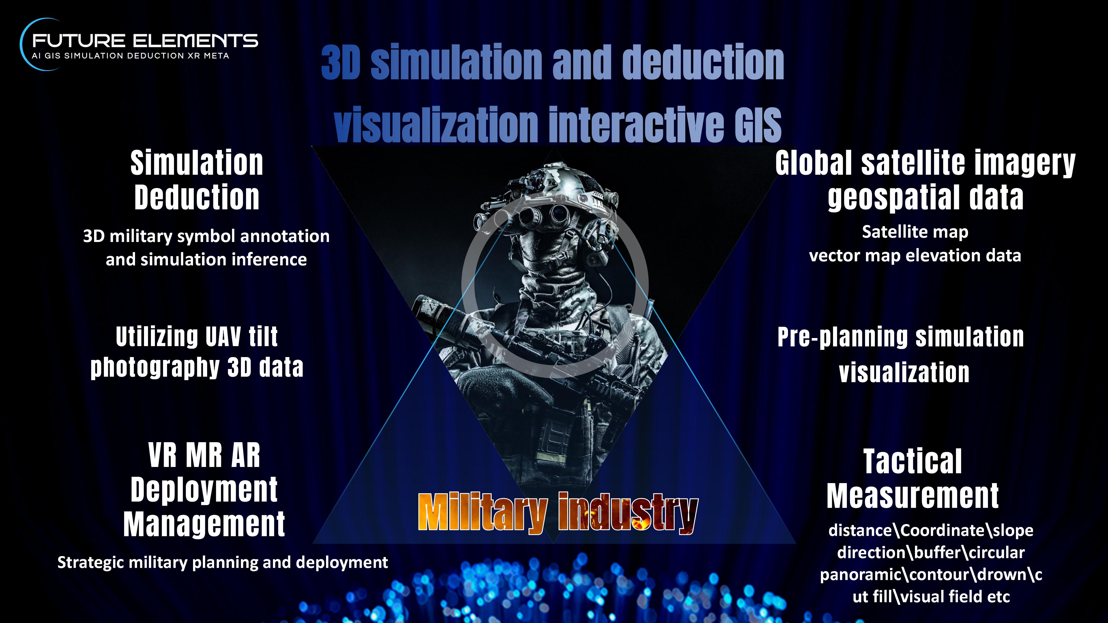
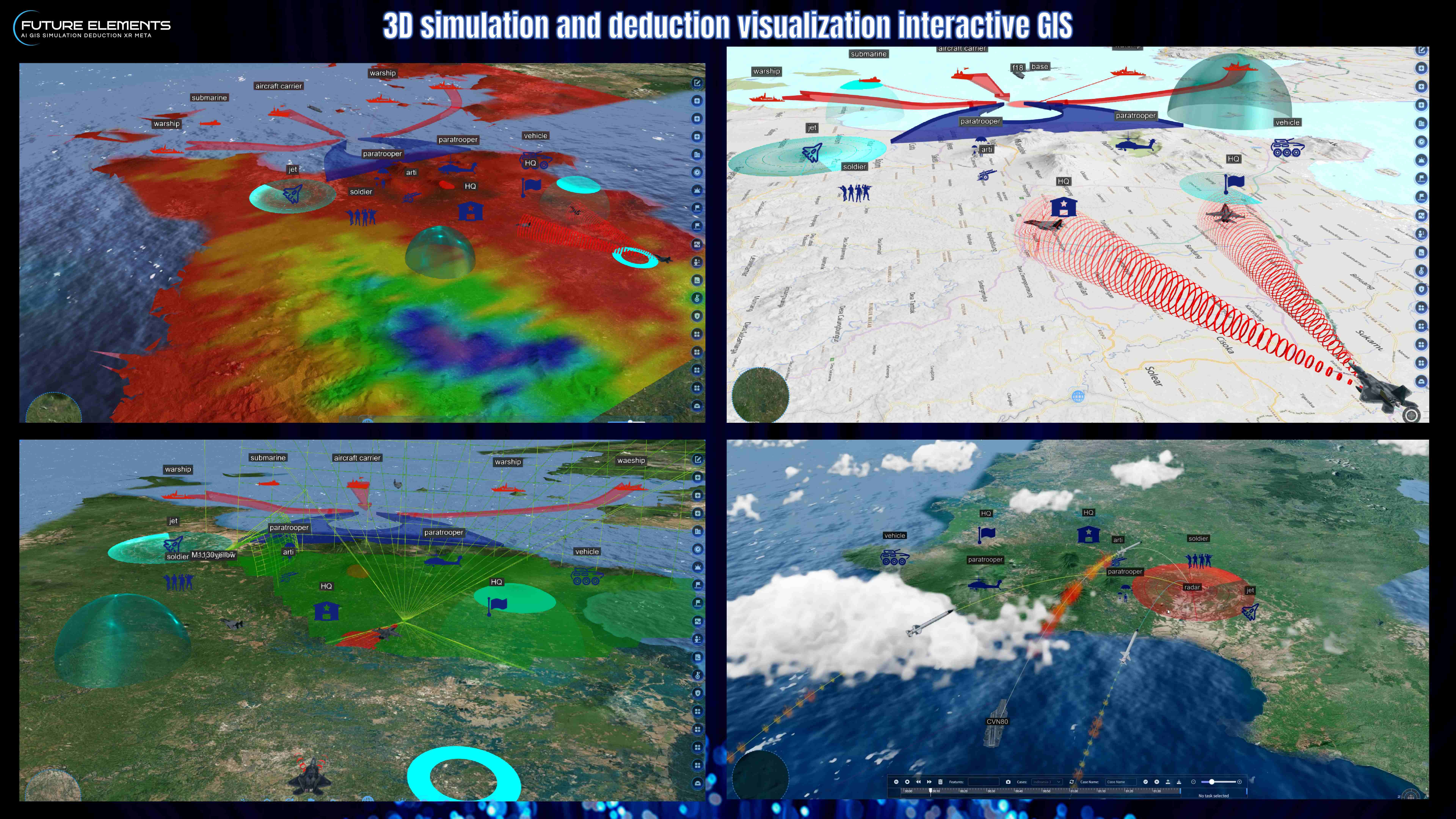
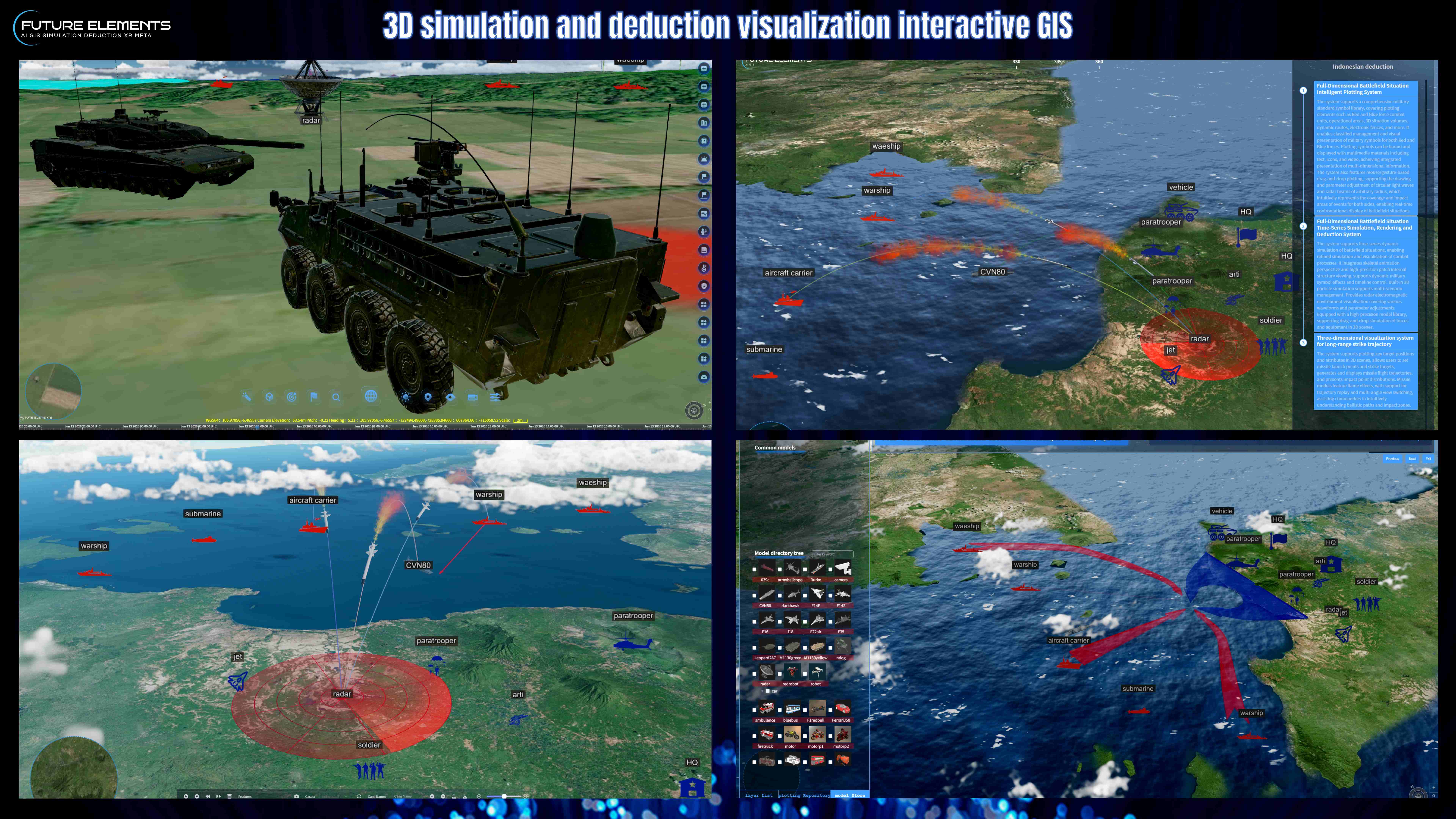
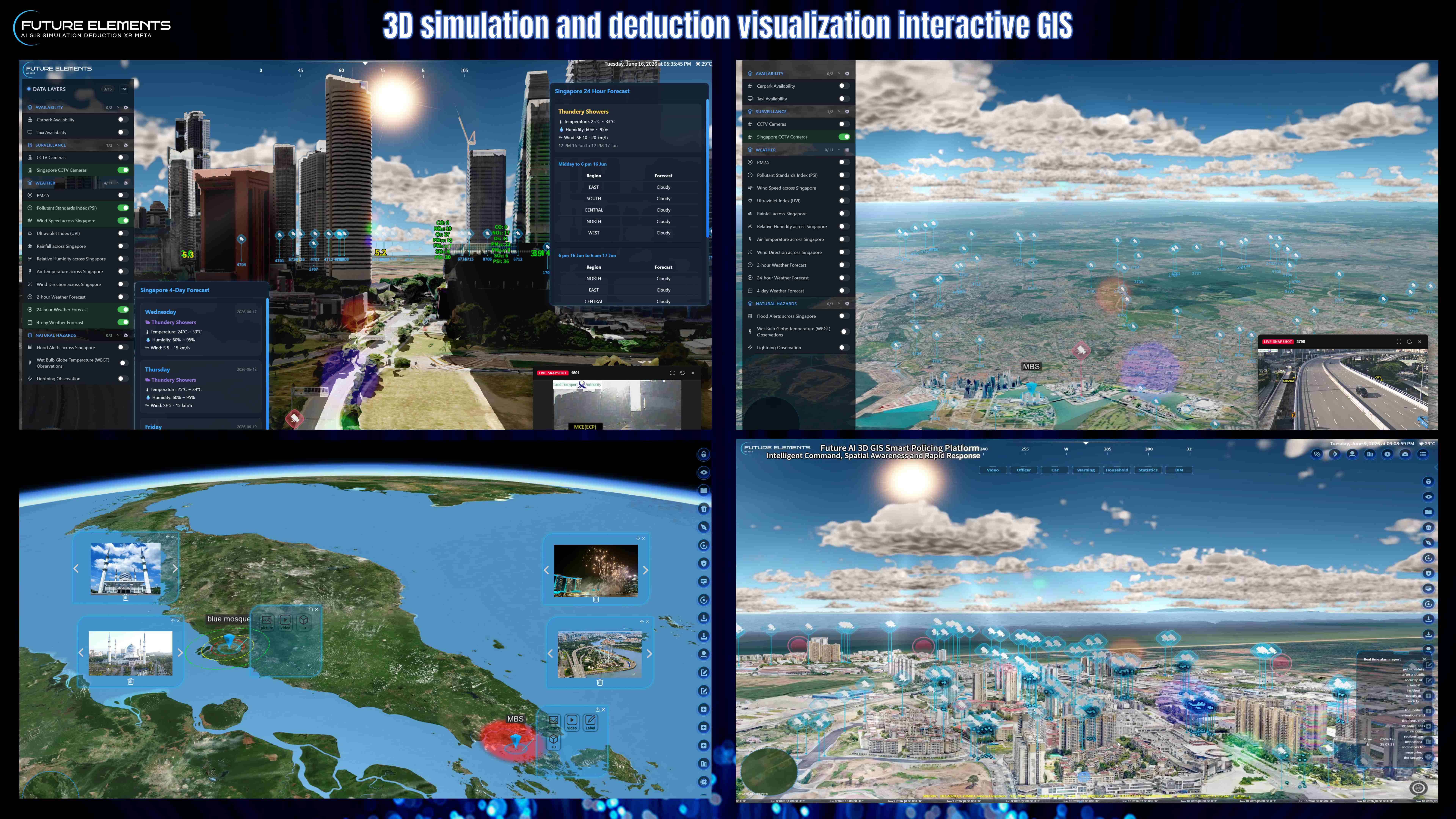
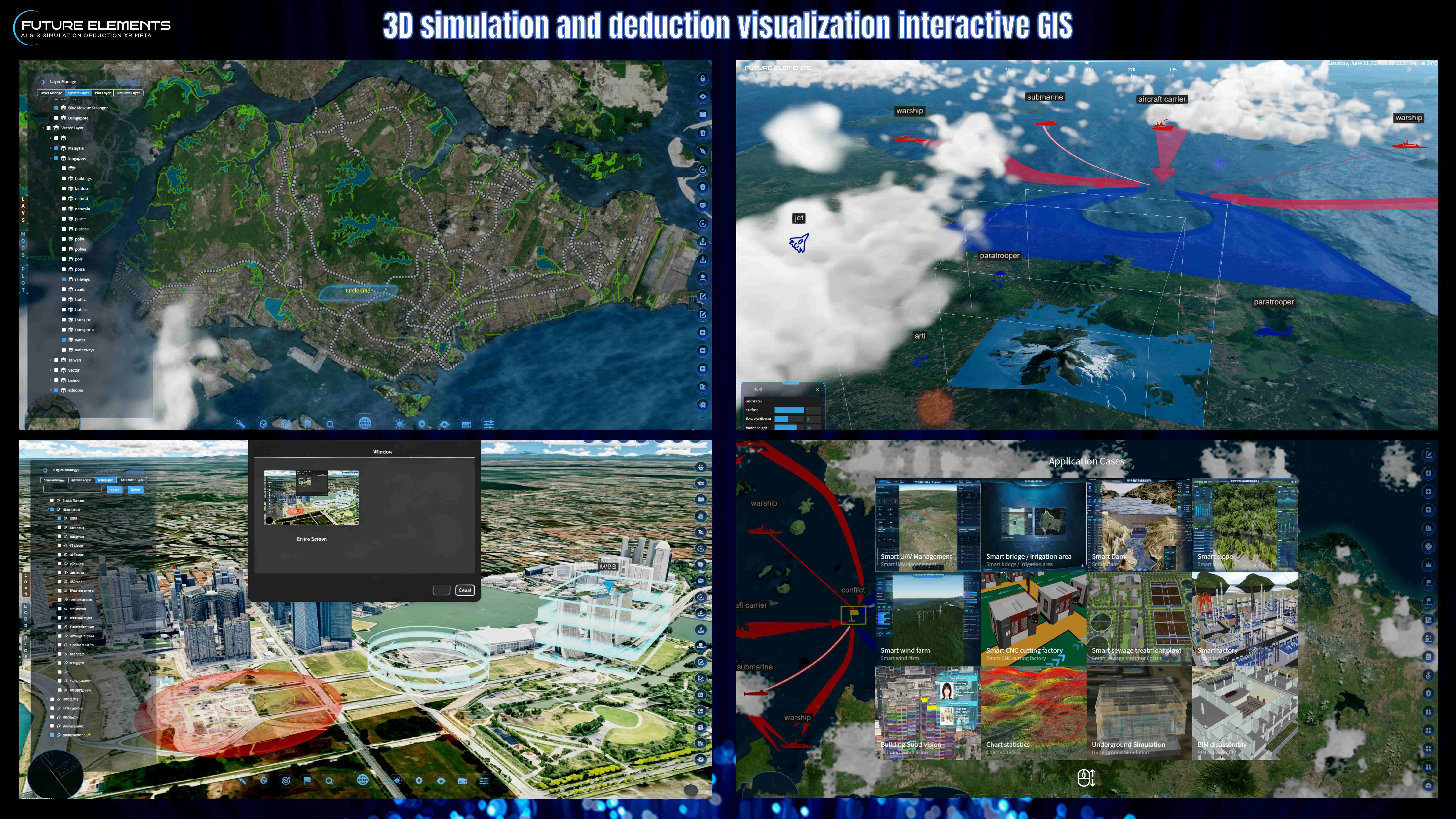
1.Full‑Dimensional Battlefield Situation Intelligent Plotting System
The system supports a comprehensive military standard symbol library, covering plotting elements such as Red and Blue force combat units, operational areas, 3D situation volumes, dynamic routes, electronic fences, and more. It enables classified management and visual presentation of military symbols for both Red and Blue forces. Plotting symbols can be bound and displayed with multimedia materials including text, icons, and video, achieving integrated presentation of multi‑dimensional information. The system also features mouse/gesture‑based drag‑and‑drop plotting, supporting the drawing and parameter adjustment of circular light waves and radar beams of arbitrary radius, which intuitively represents the coverage and impact areas of events for both sides, enabling real‑time confrontational display of battlefield situations.
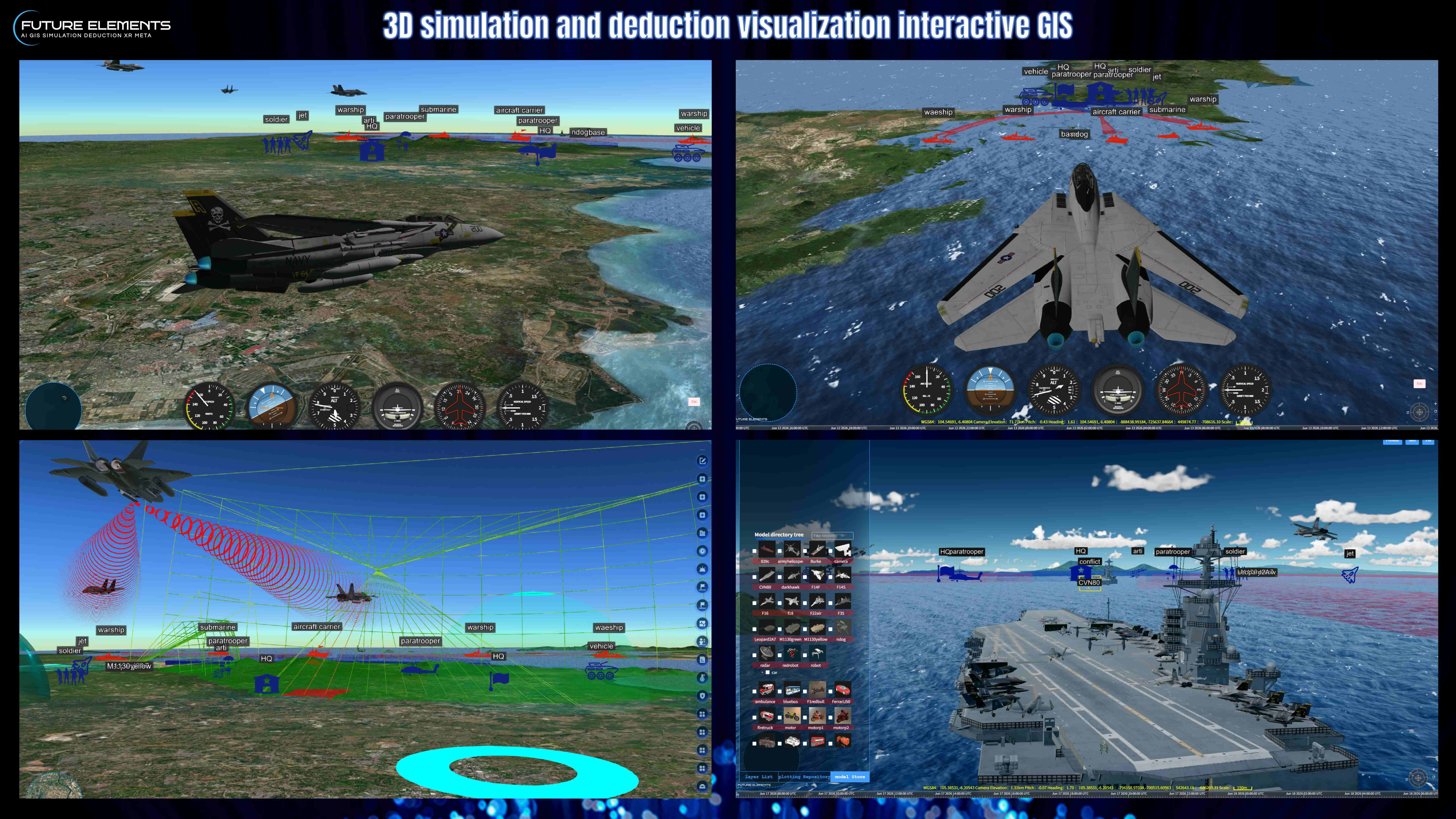
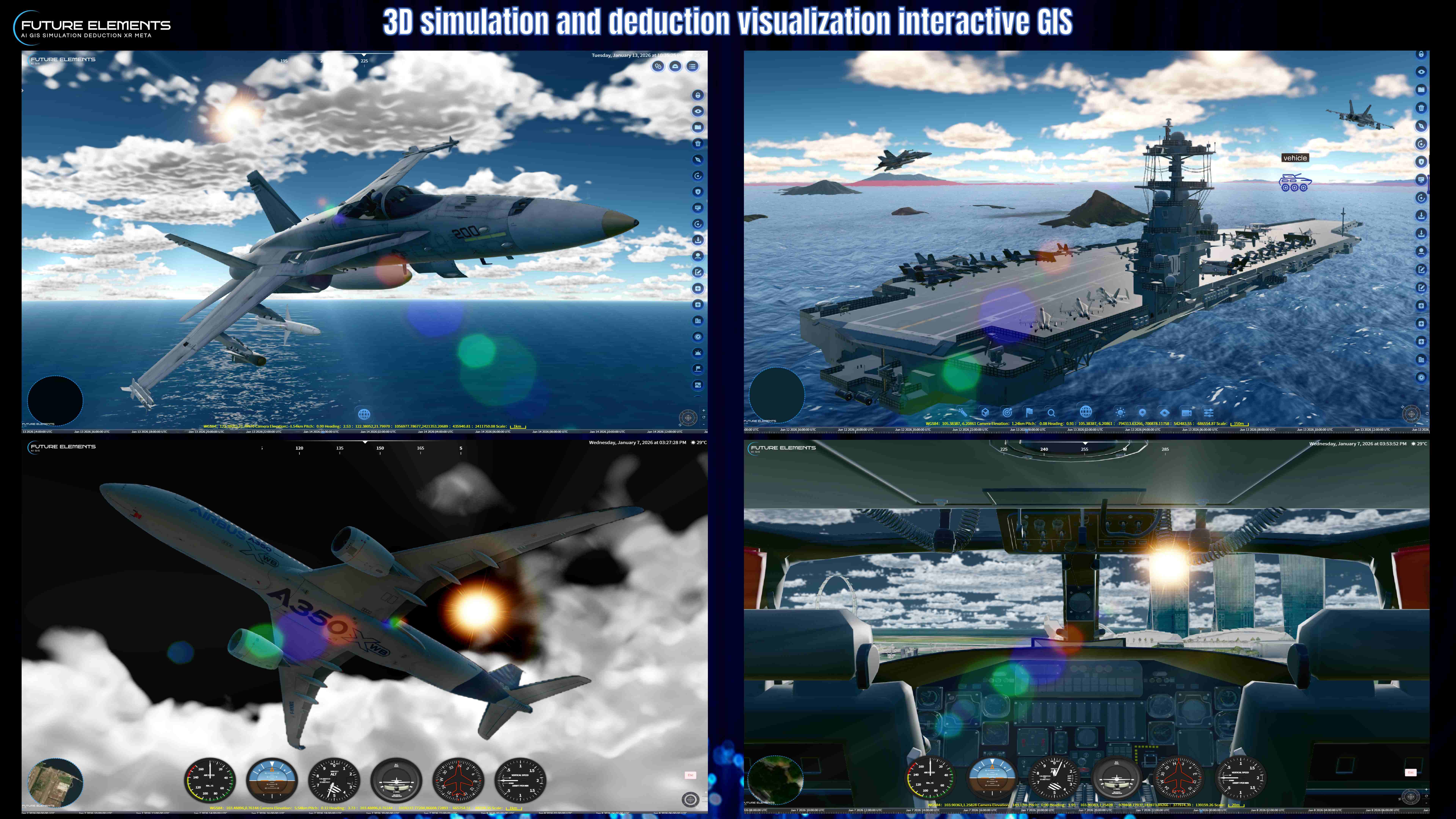
2. Full‑Dimensional Battlefield Situation Time‑Series Simulation, Rendering and Deduction System
The system supports time‑series dynamic simulation of battlefield situations, enabling refined simulation and visualisation of combat processes. It integrates skeletal animation perspective and high‑precision patch internal structure viewing, supports dynamic military symbol effects and timeline control. Built‑in 3D particle simulation supports multi‑scenario management. Provides radar electromagnetic environment visualisation covering various waveforms and parameter adjustments. Equipped with a high‑precision model library, supporting drag‑and‑drop simulation of forces and equipment in 3D scenes.
3.Long-range Strike Trajectory 3D Visualization System
The system supports plotting key target positions and attributes in 3D scenes, allows users to set missile launch points and strike targets, generates and displays missile flight trajectories, and presents impact point distributions. Missile models feature flame effects, with support for trajectory replay and multi‑angle view switching, assisting commanders in intuitively understanding ballistic paths and impact zones.
(The Intelligent Full-Dimensional Battlefield Situation Plotting and Deduction System, through artificial intelligence technology, can automatically locate specified coordinates, set the center of the operational area, generate an exercise operational zone with a radius of 10,000 meters, highlight the boundary with semi‑transparent light red and mark it as the Red Army exercise area, simultaneously plot the highest point within the area and mark it with a red triangular flag indicating its coordinates and altitude, thereby enabling rapid deployment of subsequent forces, route planning, and operational simulation