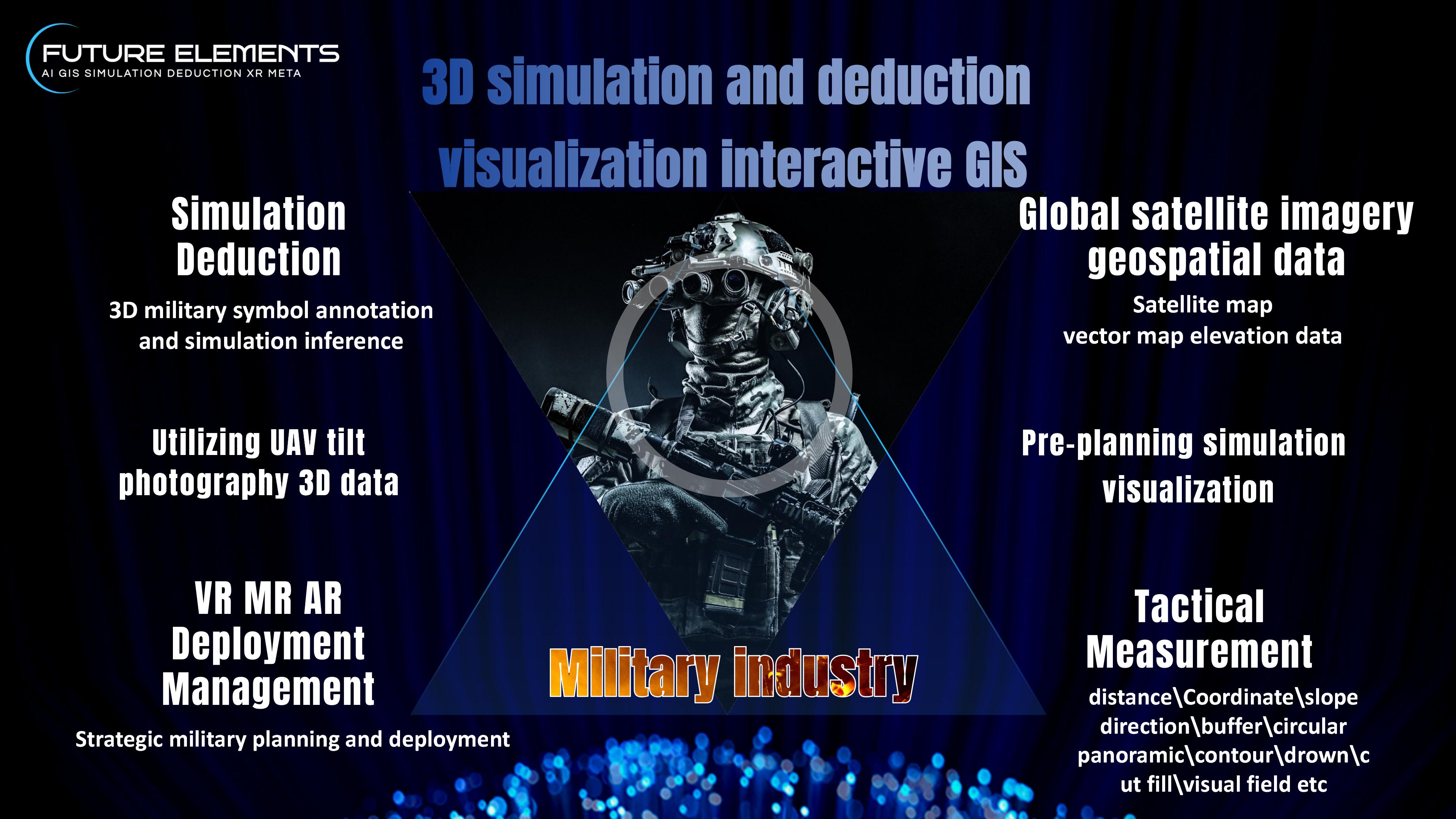
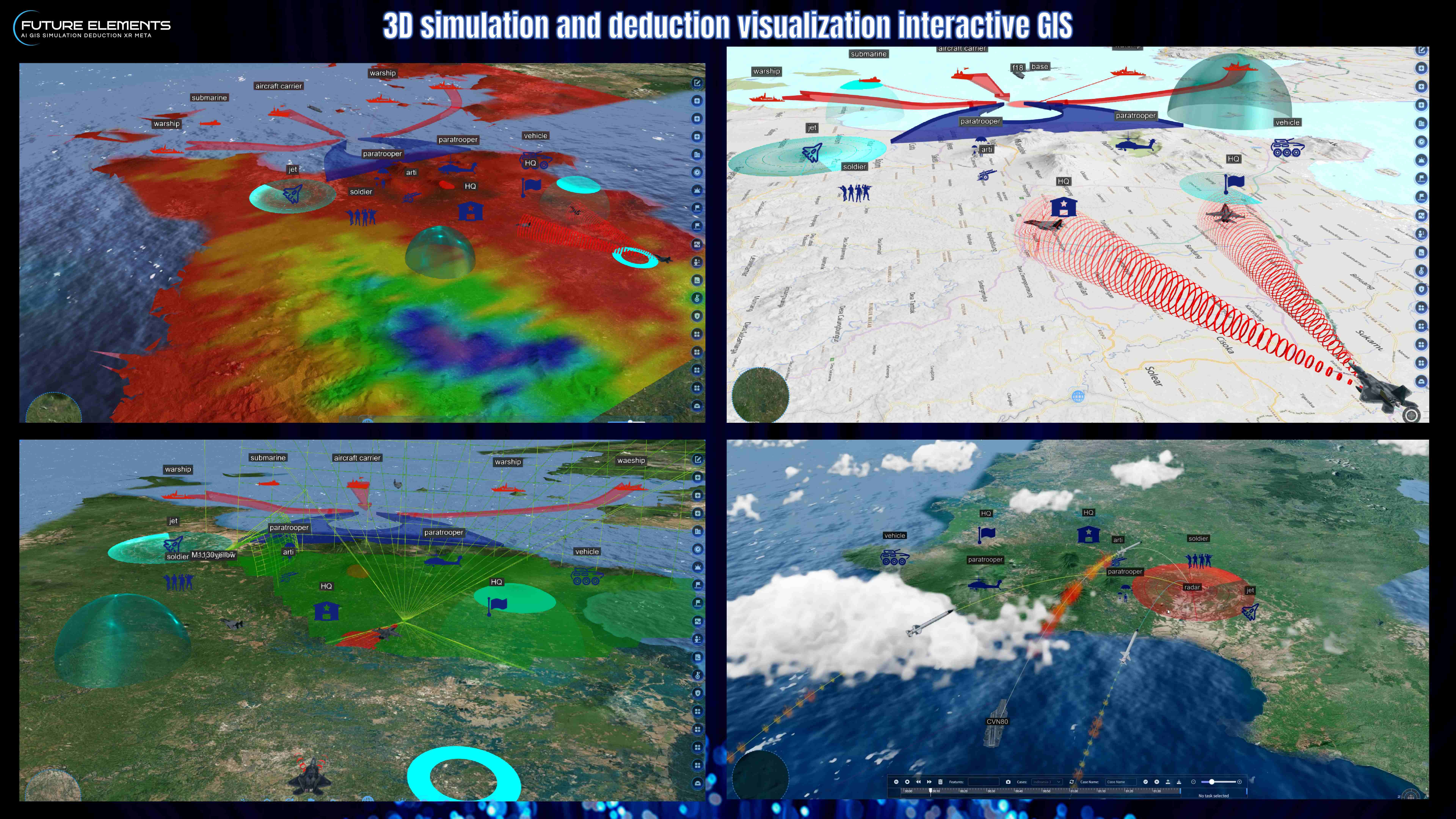
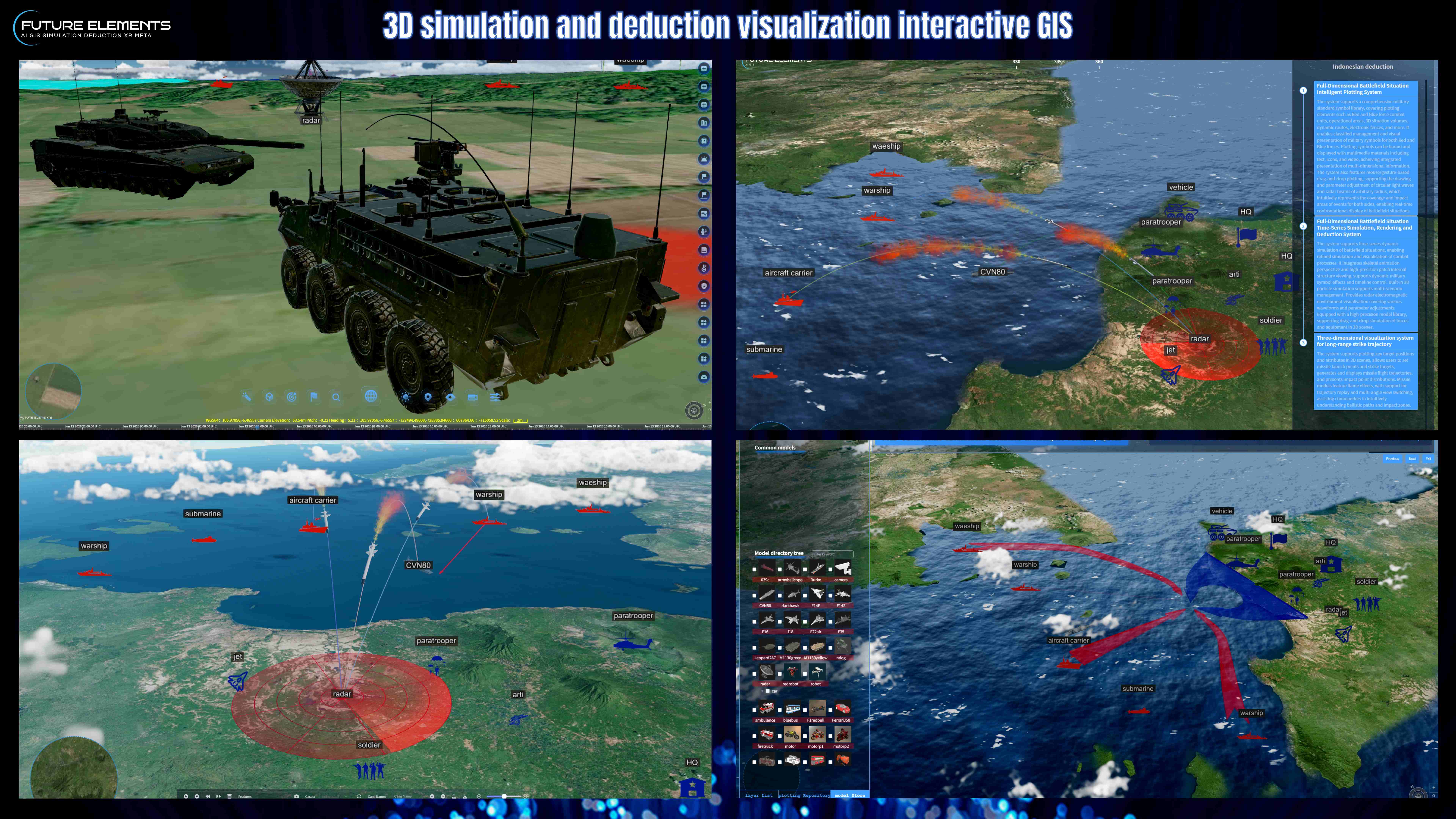
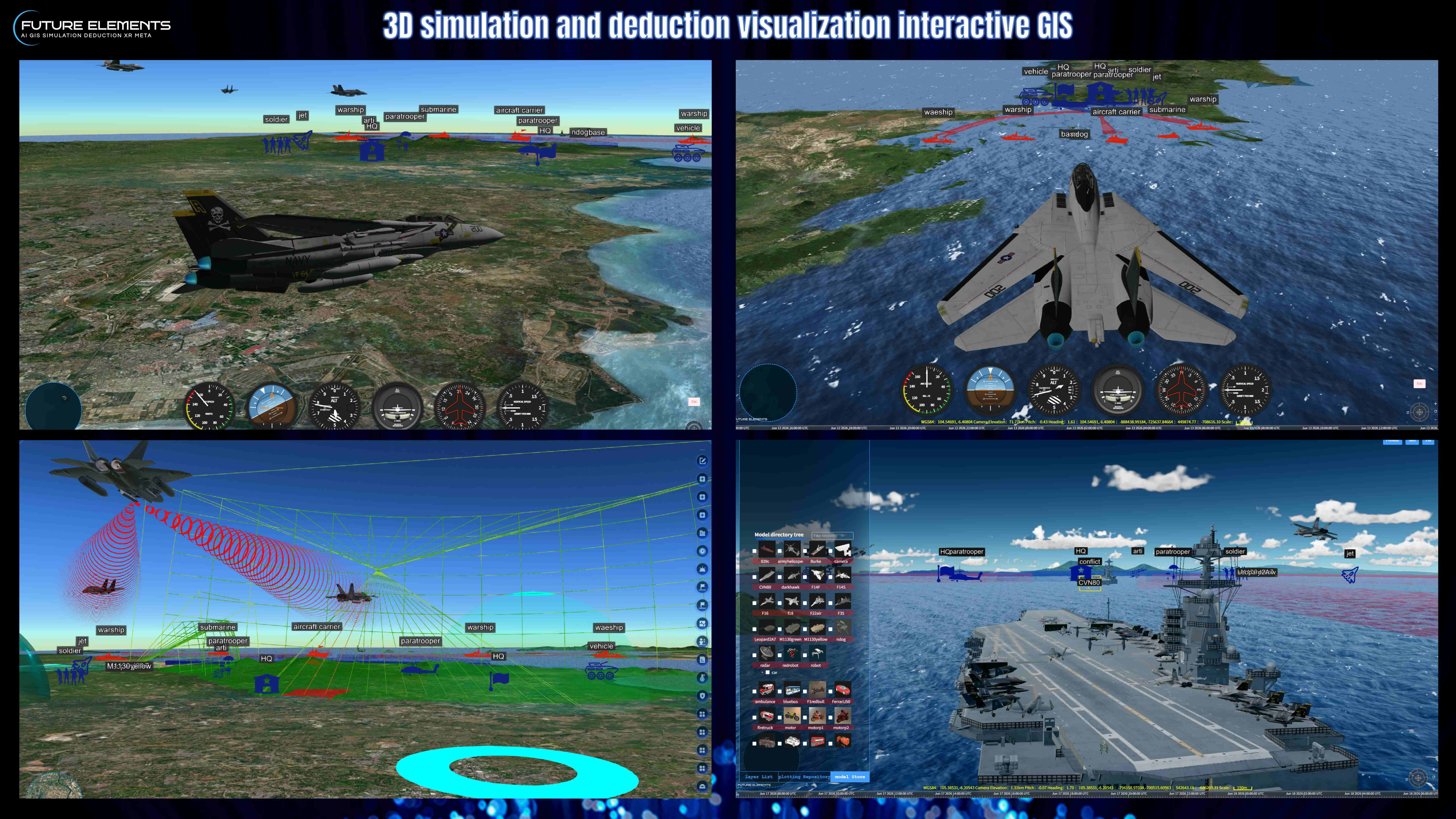
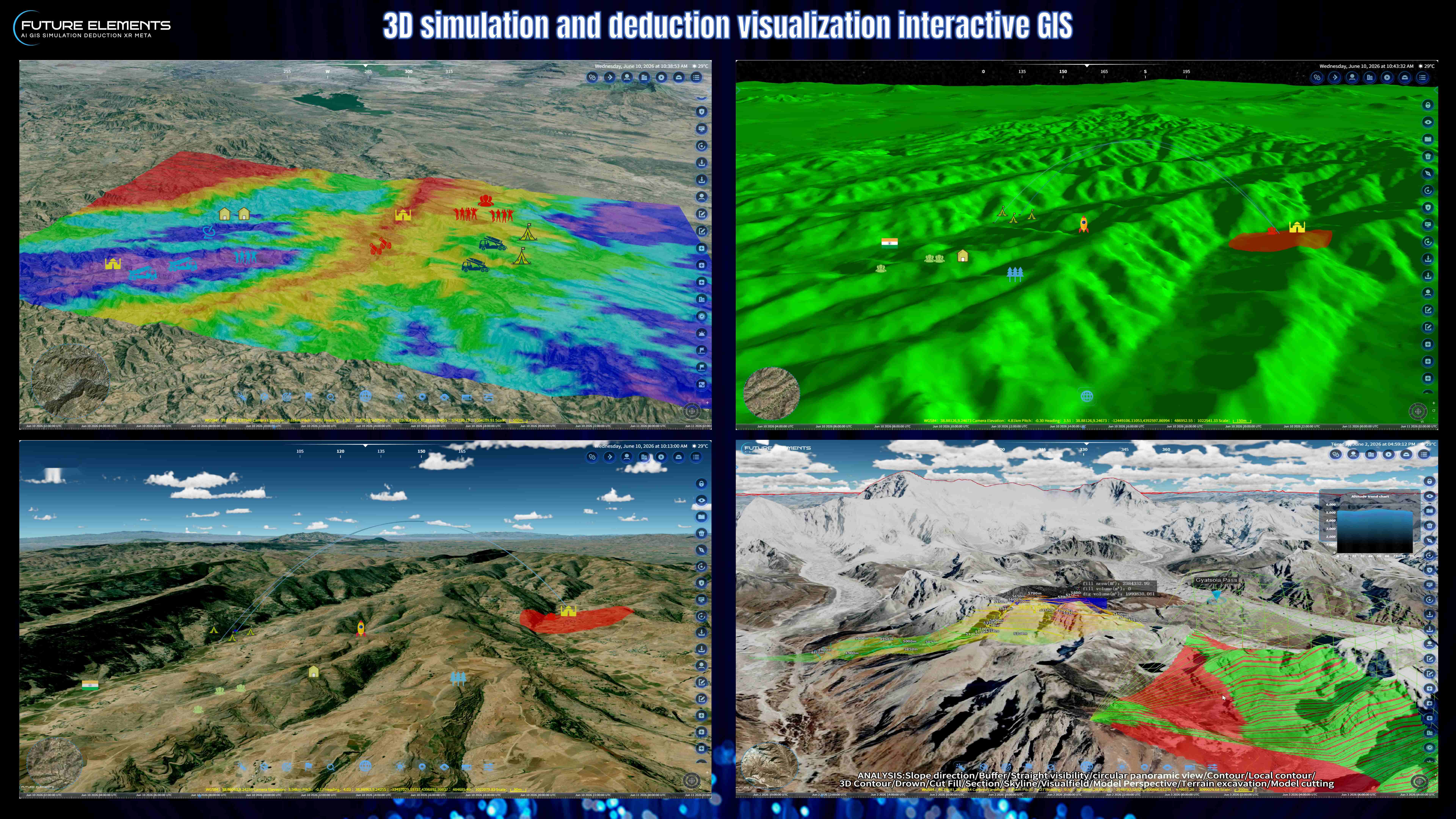
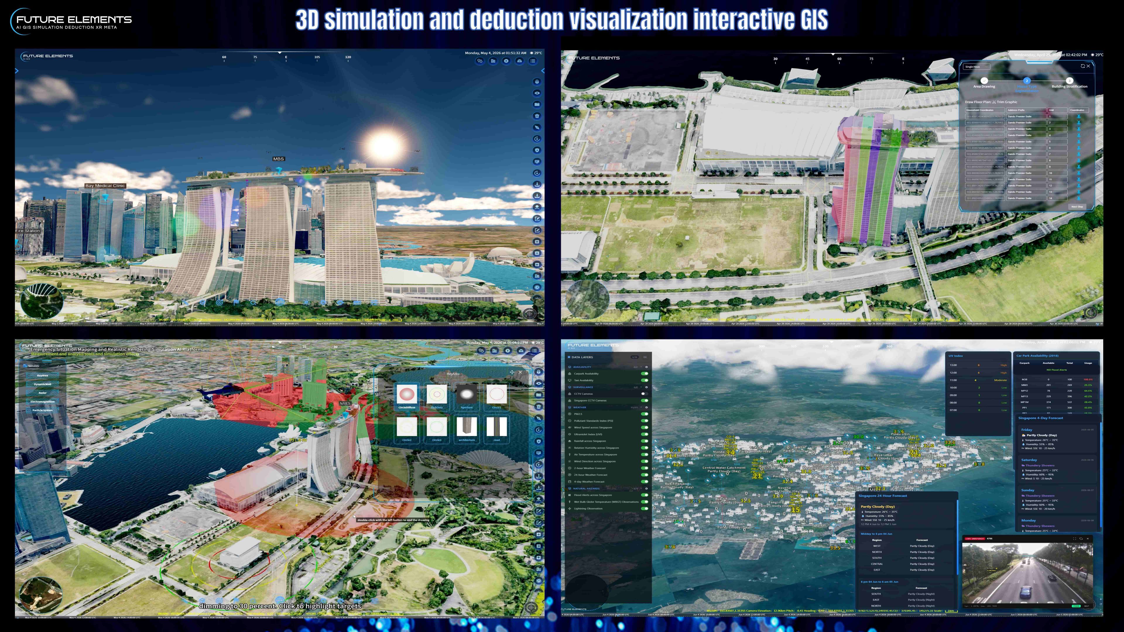
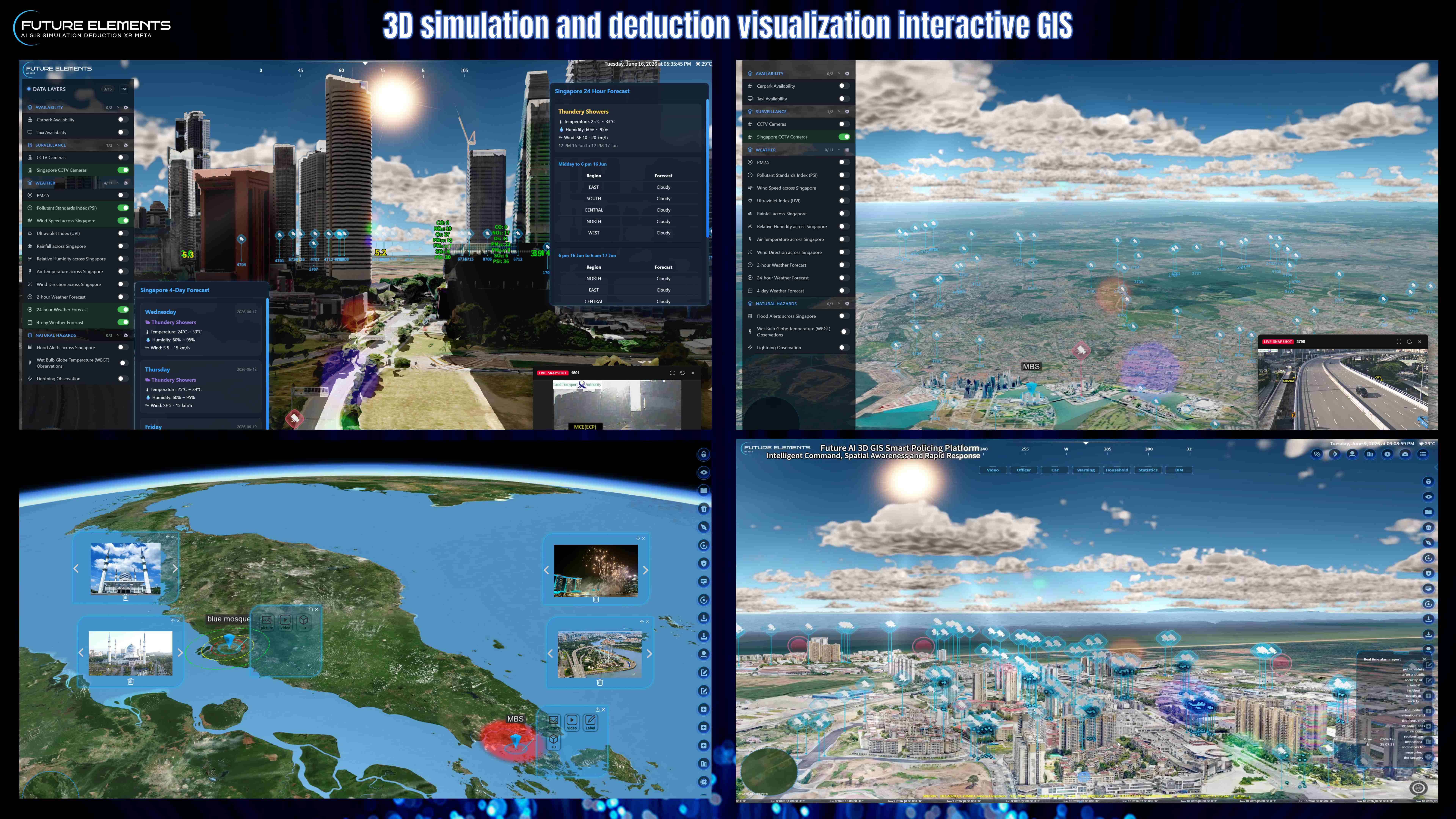
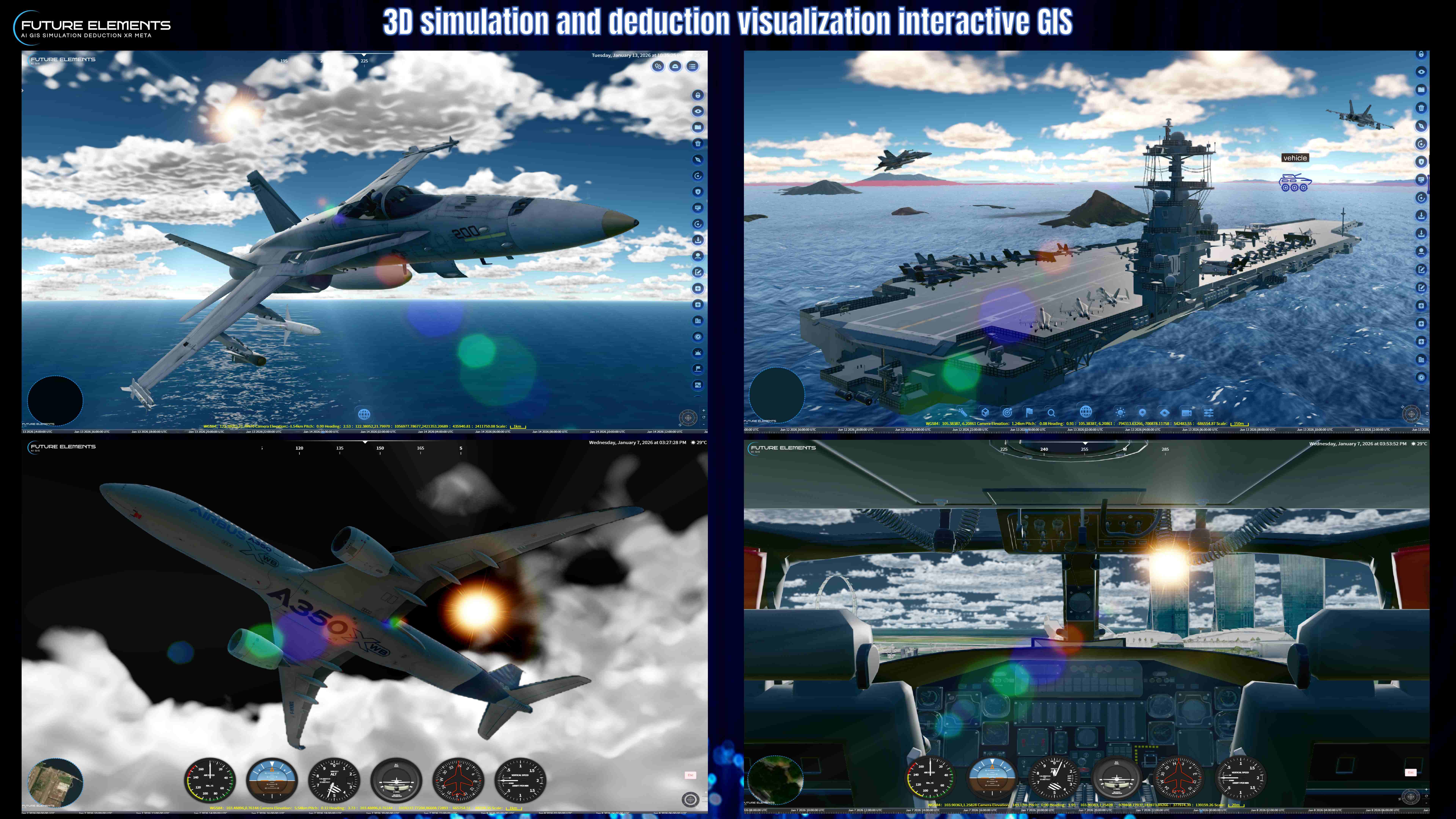
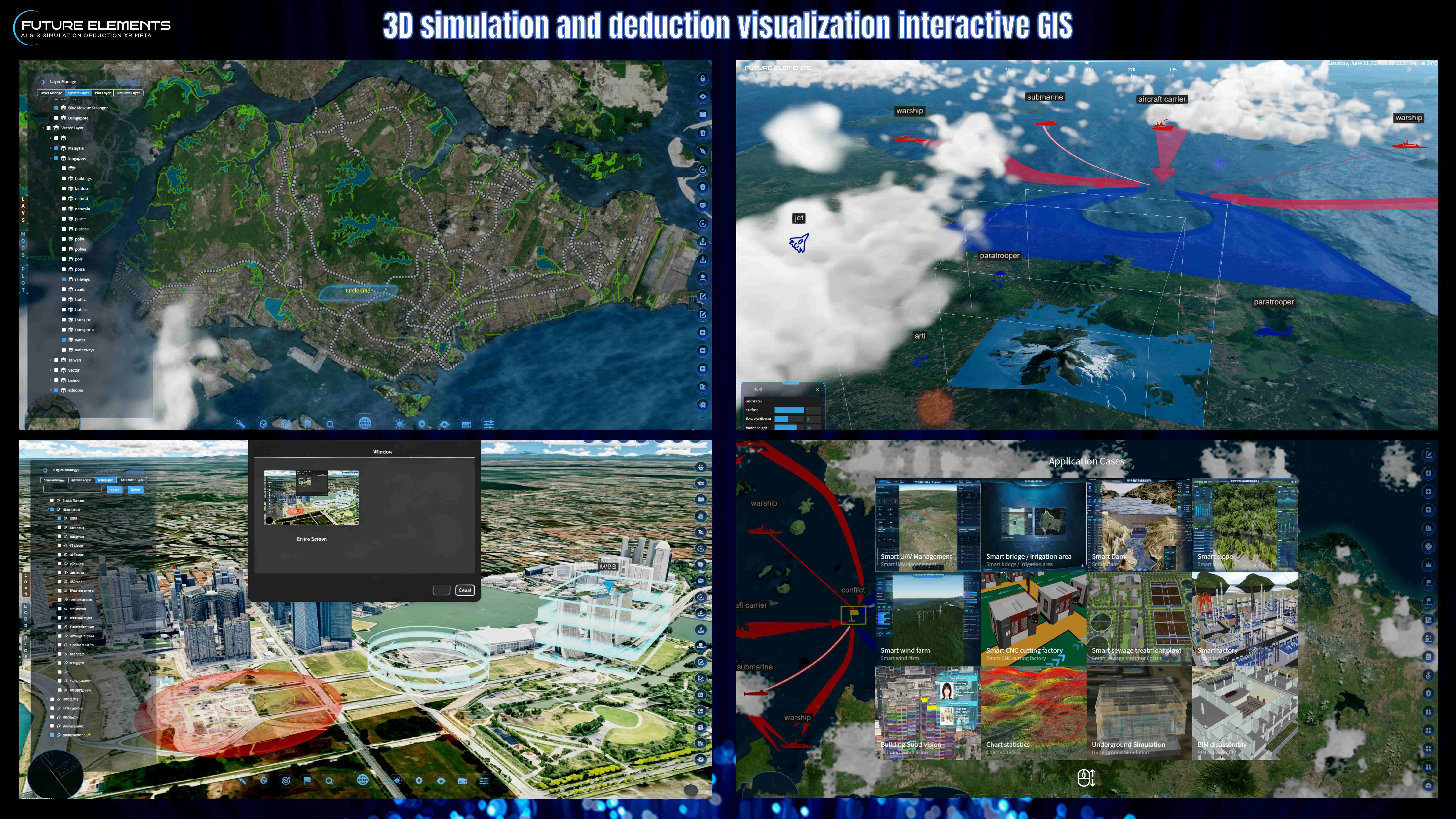
Discover the powerful measurement functions in FUTURE AI 3DGIS, designed for accurate spatial analysis, digital twin operations and smart city planning.
In this video, we showcase essential GIS measurement tools including coordinate measurement, distance calculation, area measurement, height measurement, height difference analysis, angle measurement and azimuth angle detection. These tools help users quickly understand terrain, buildings, infrastructure and spatial relationships in a 3D map environment.
Whether you are working on urban planning, land analysis, infrastructure management, emergency response, security operations or digital twin visualization, accurate GIS measurement is key to better decision-making.
FUTURE AI 3DGIS makes spatial measurement faster, clearer and more intuitive.
By: Future Elements Technology (Singapore)