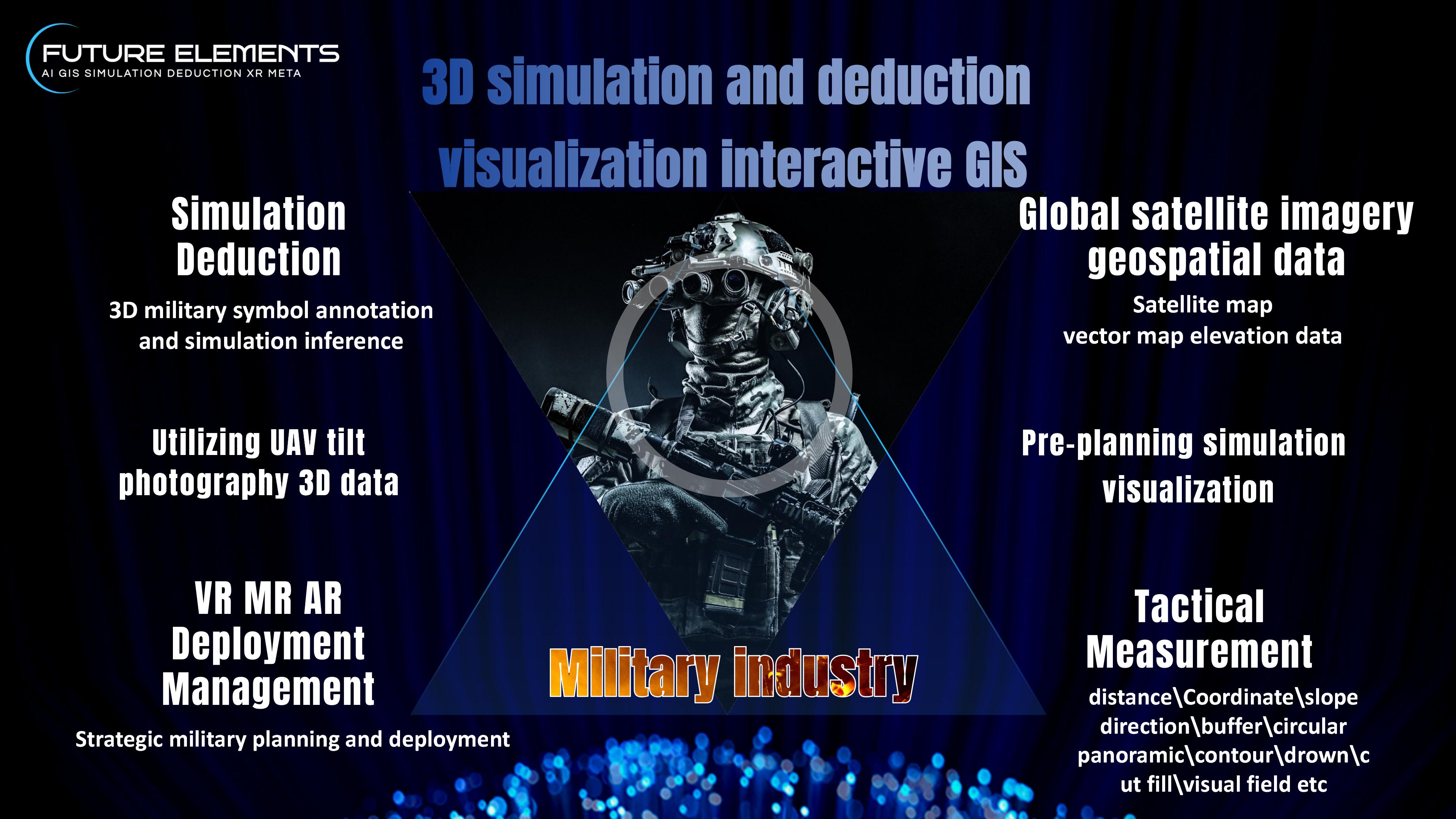
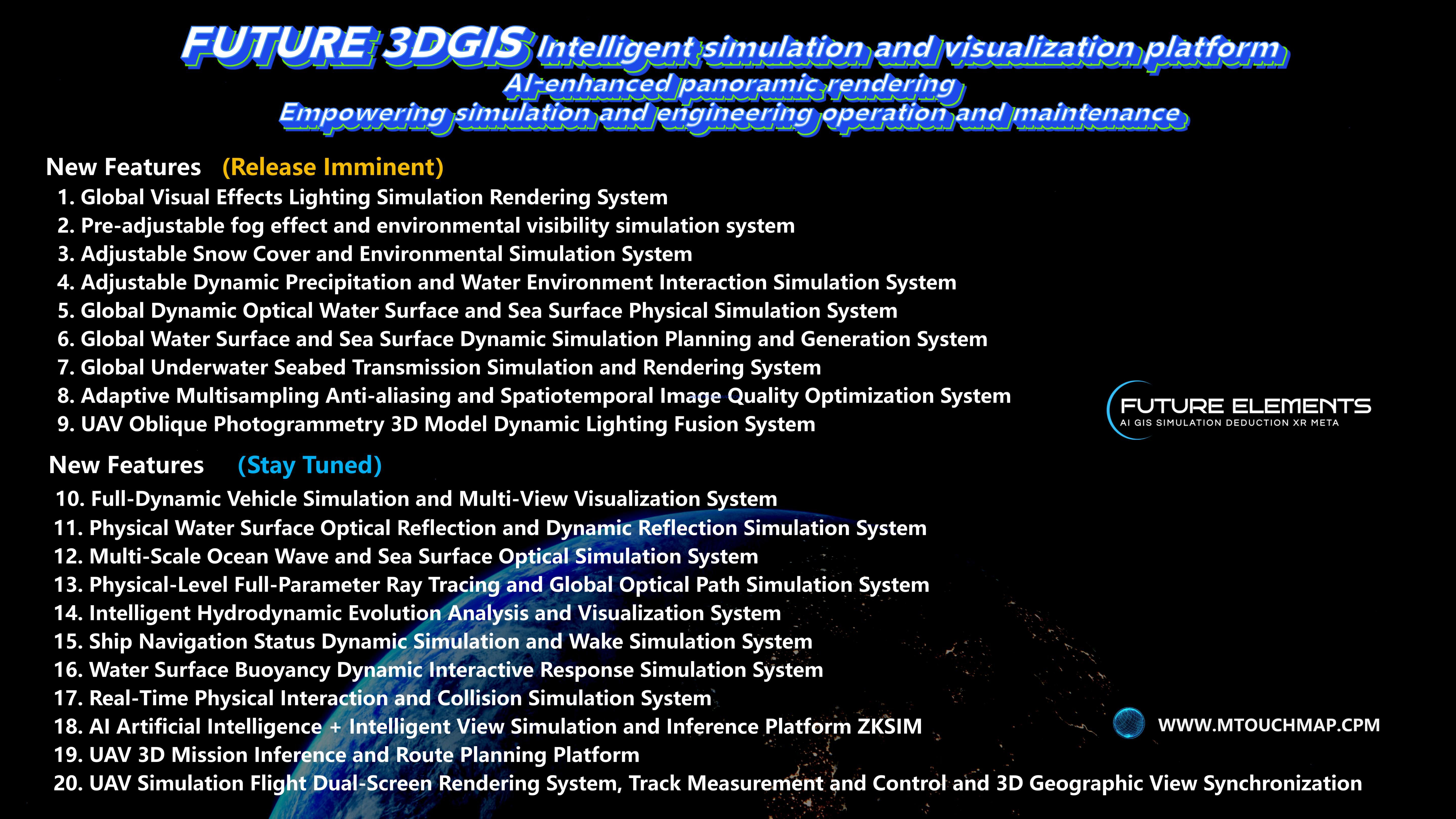
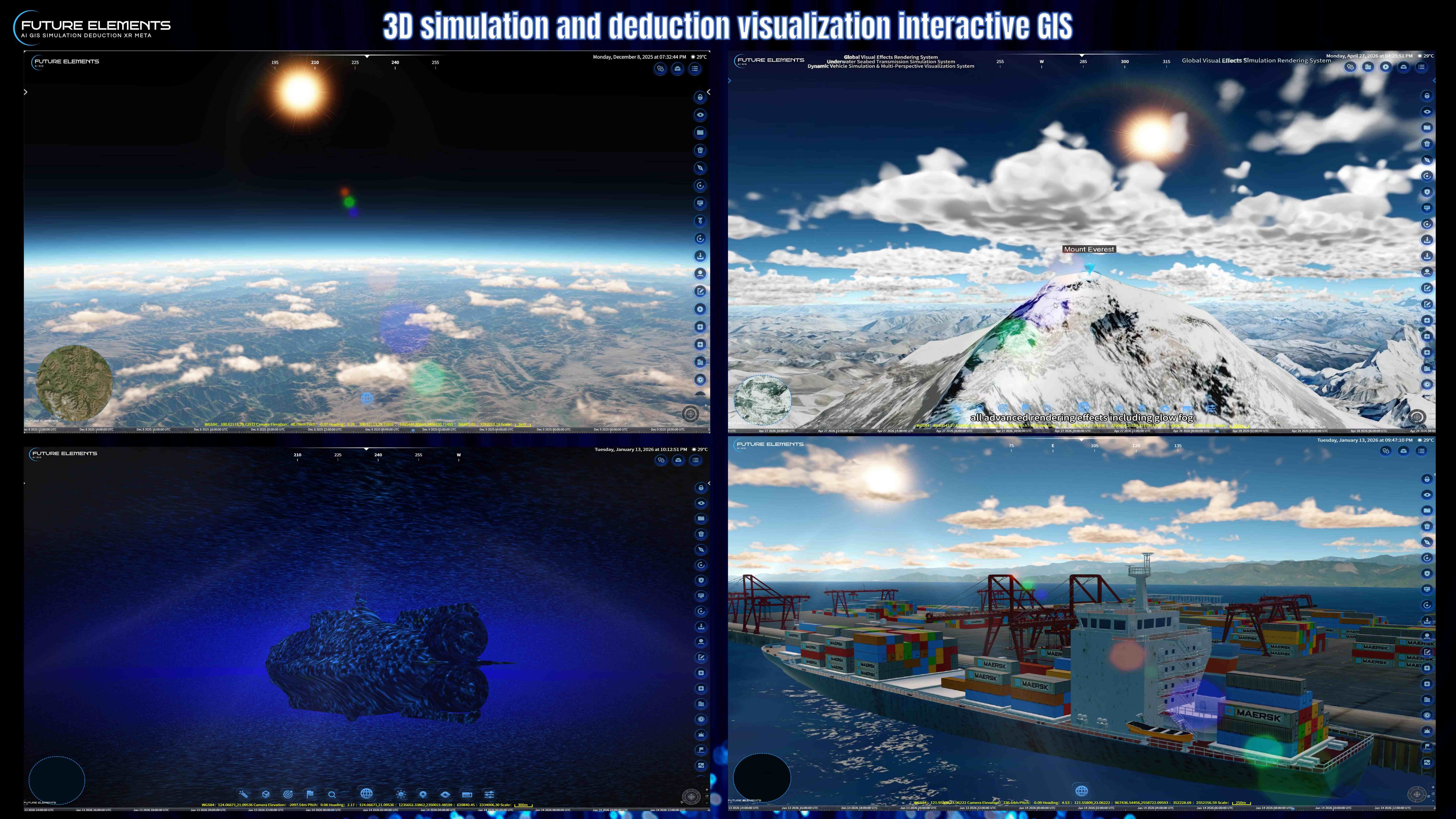
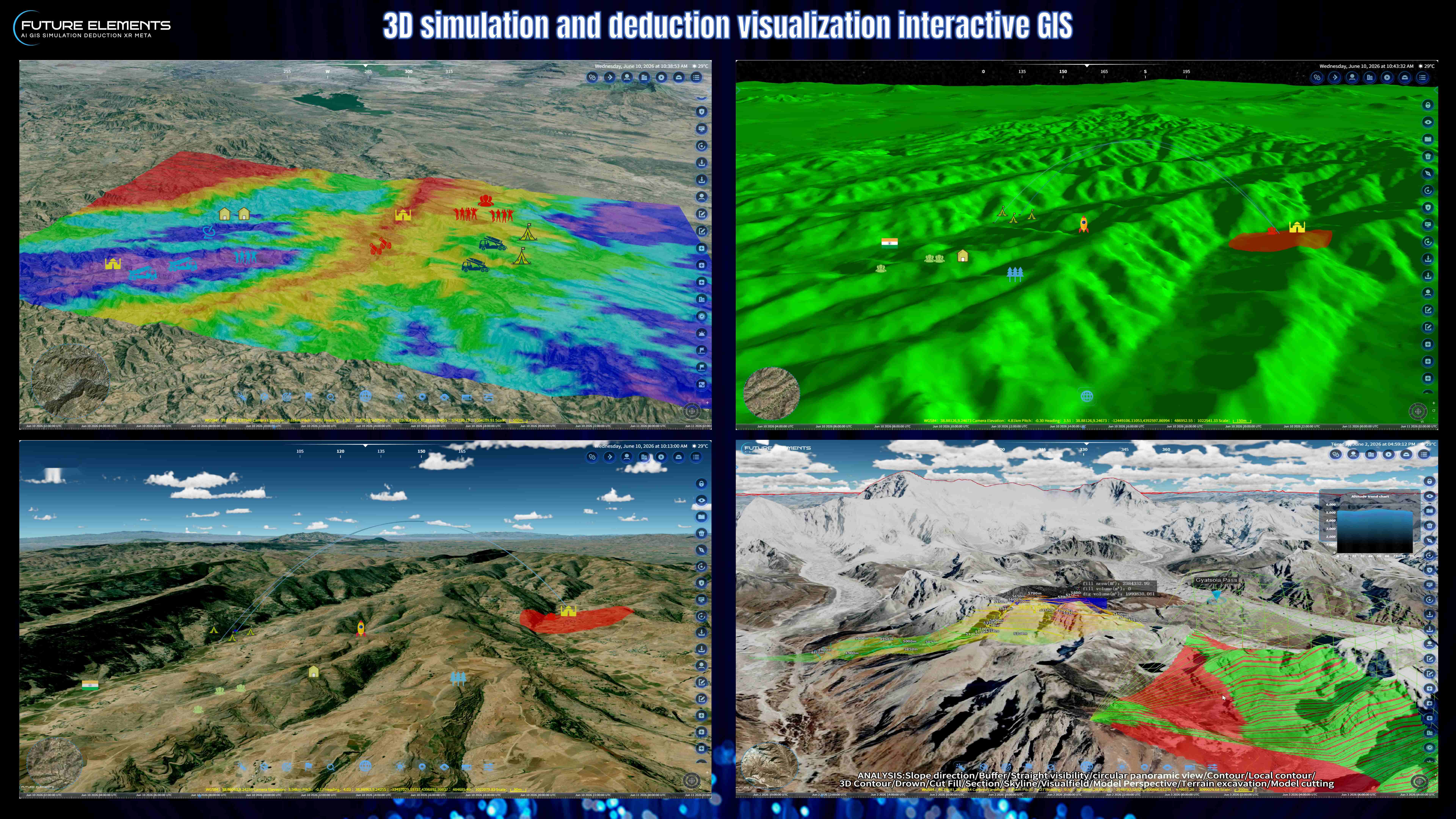
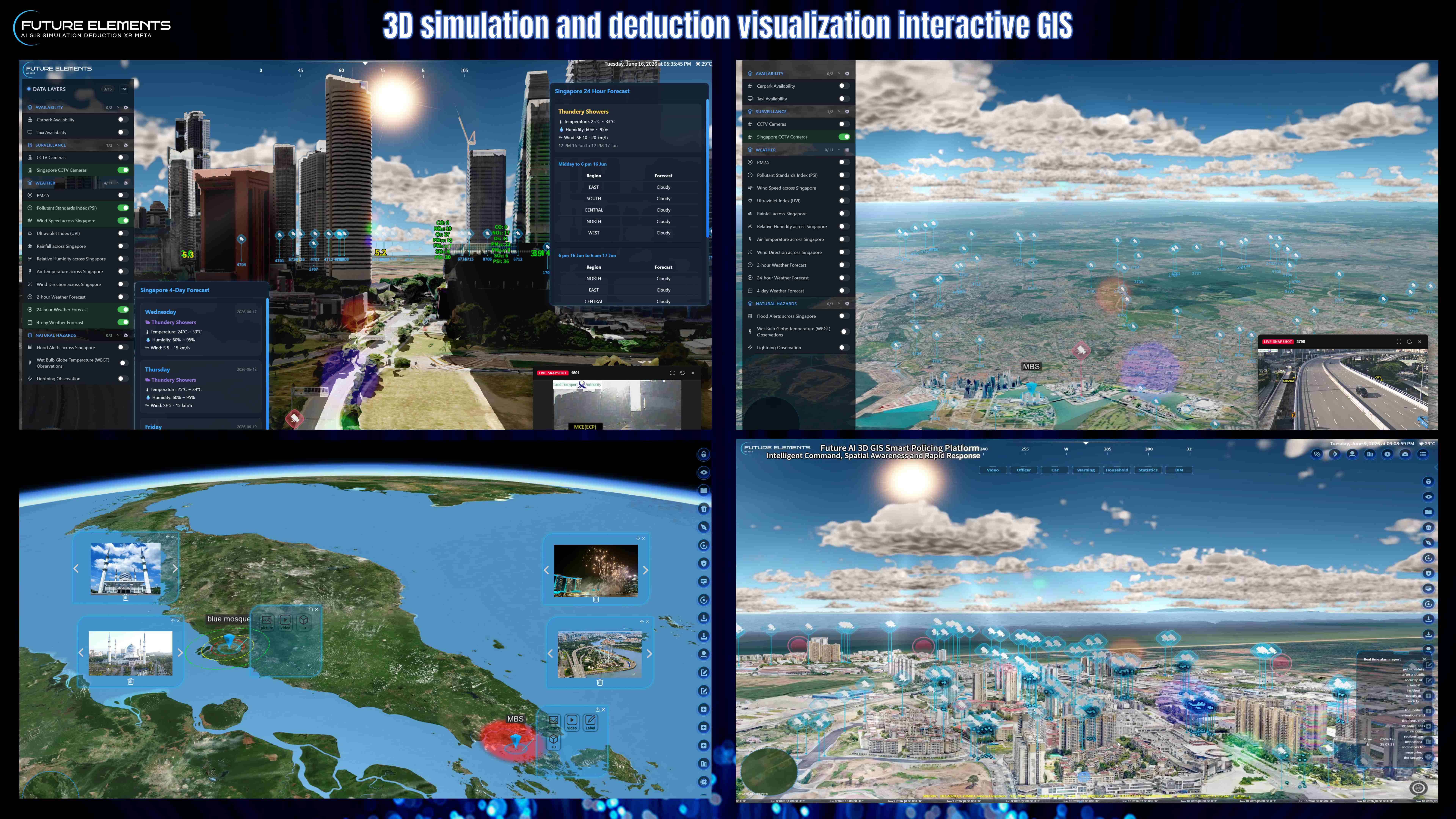
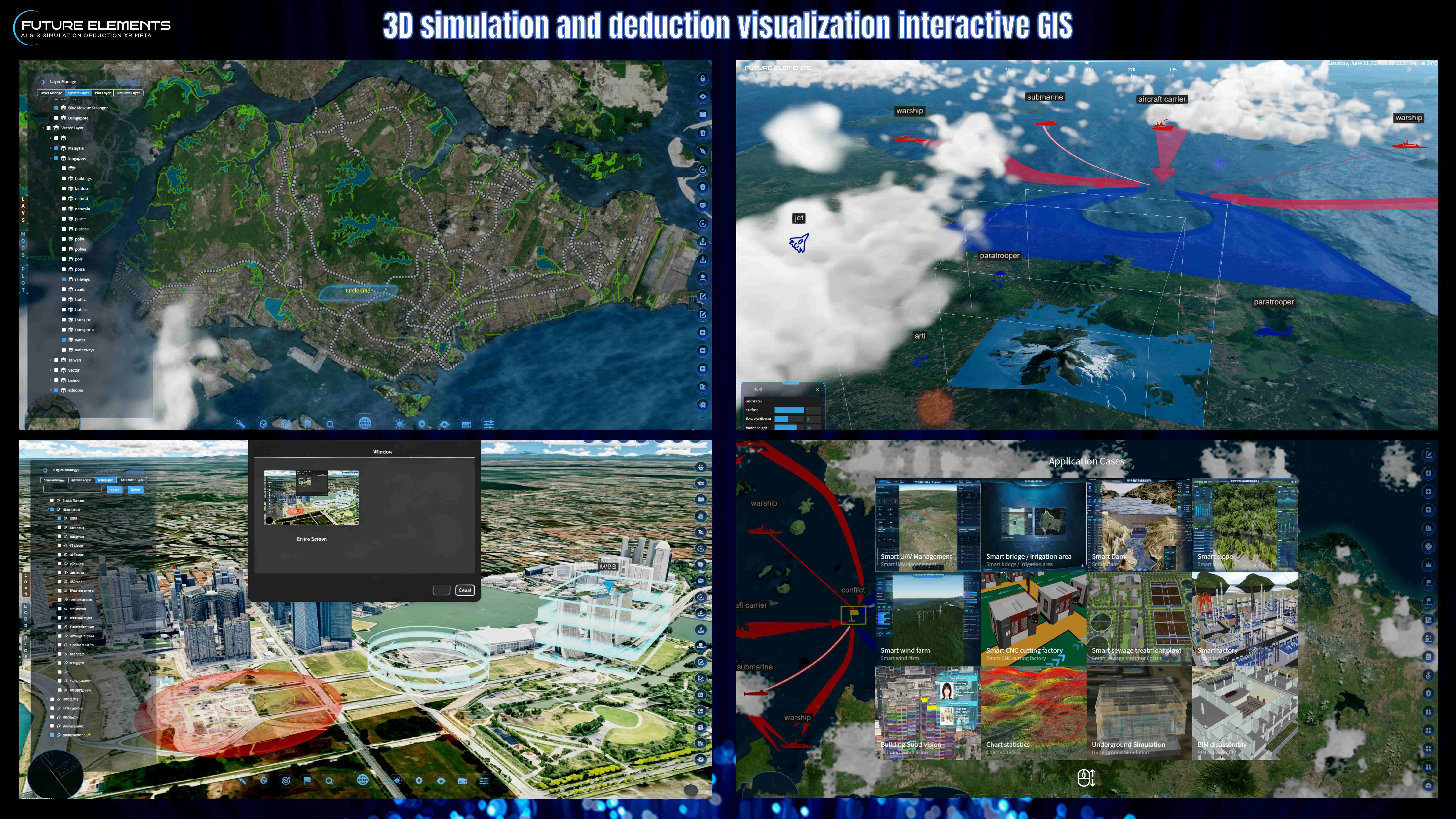
Explore the advanced analysis capabilities of FUTURE AI 3DGIS, designed for smarter spatial planning, terrain uation, infrastructure analysis and digital twin operations.
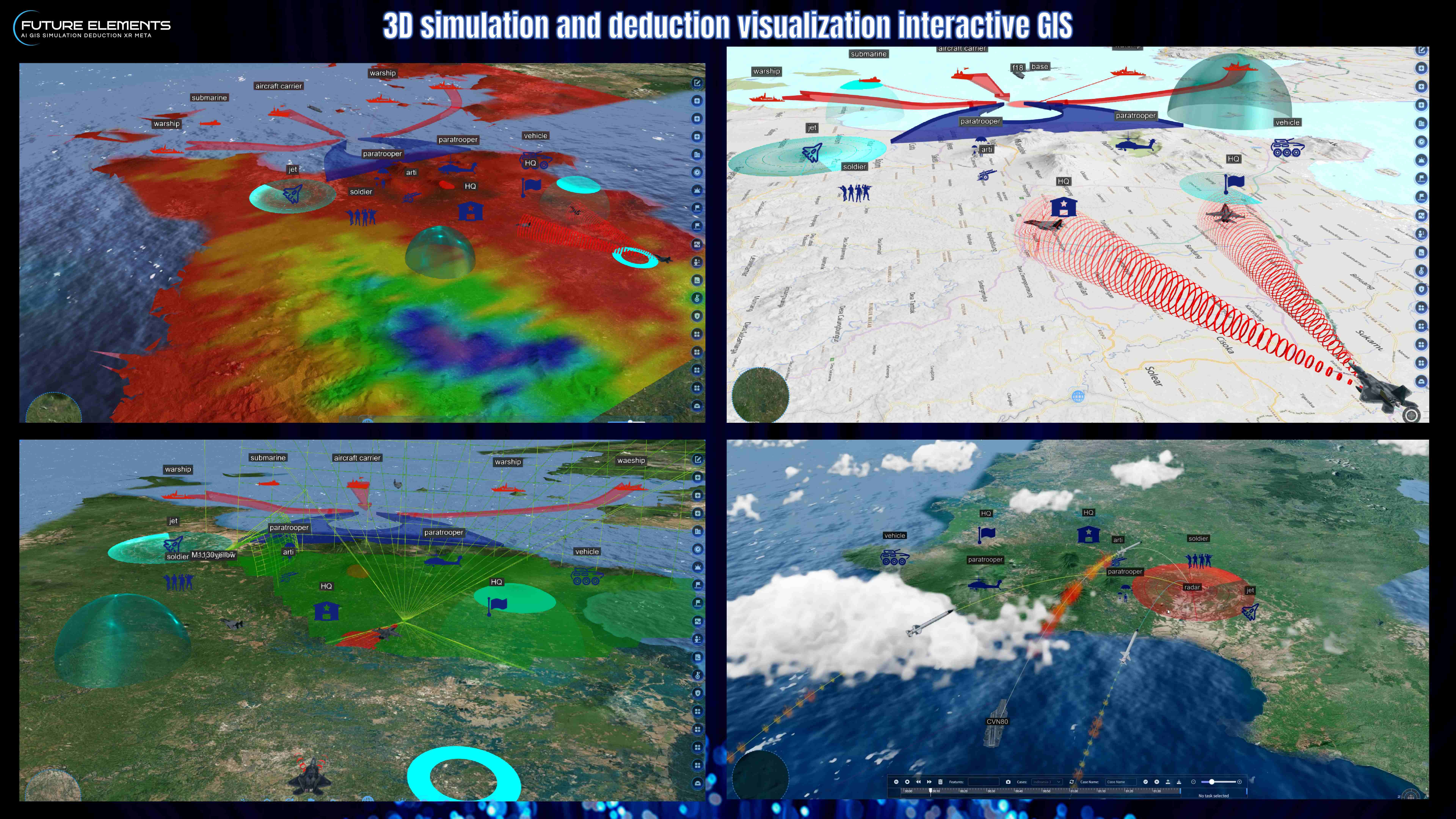
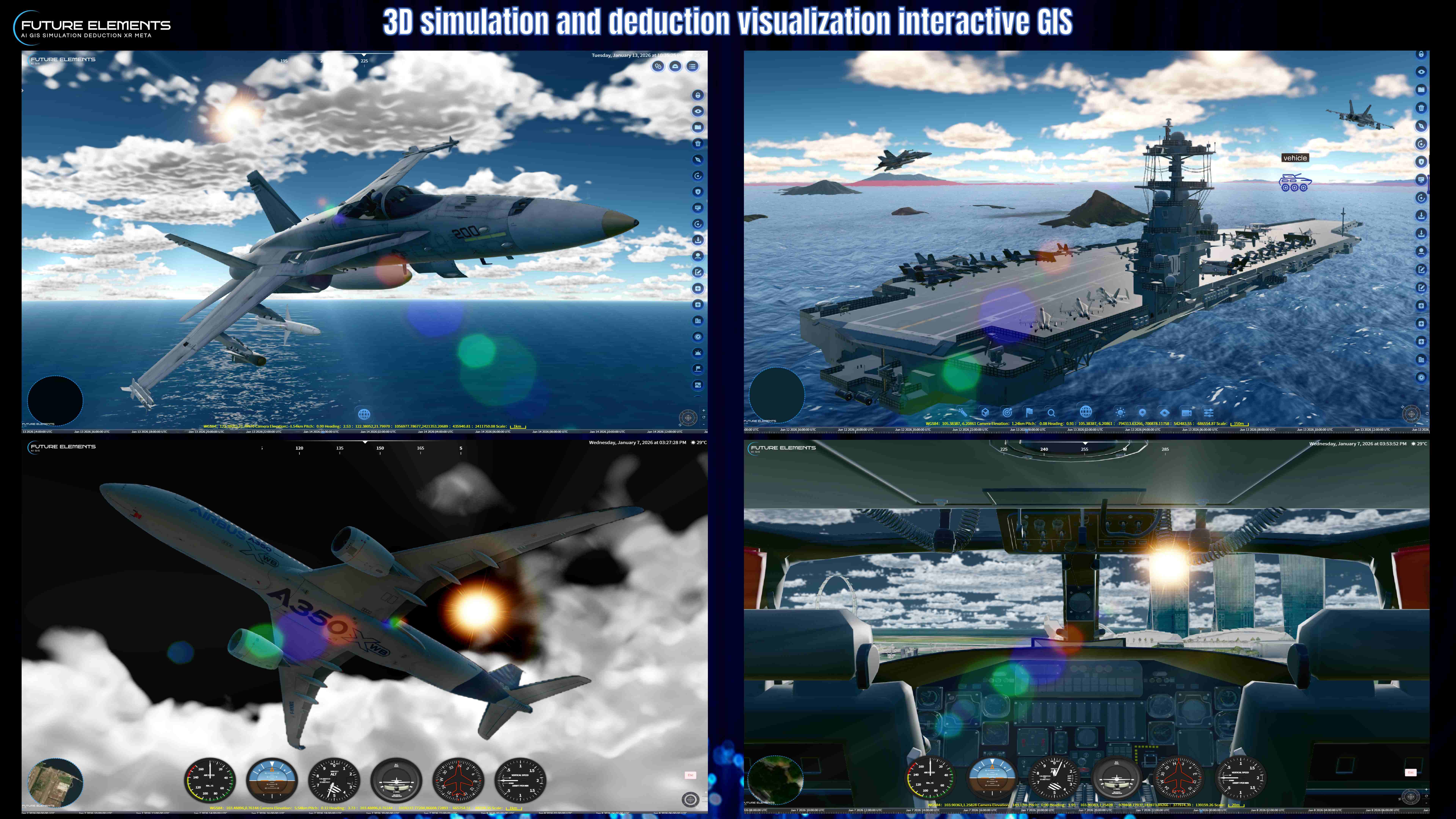
In this video, we showcase a wide range of GIS analysis tools, including slope direction analysis, buffer analysis, straight visibility, circular panoramic view, contour generation, local contour, 3D contour, drowning analysis, cut and fill calculation, section analysis, skyline analysis, visual field analysis, model perspective, terrain excavation and model cutting.
These functions help users better understand terrain conditions, visibility impact, elevation changes, infrastructure relationships and spatial constraints within a 3D GIS environment.
Whether applied to urban planning, smart city development, construction planning, emergency response, security operations or infrastructure management, FUTURE AI 3DGIS provides powerful analysis tools to support faster and more informed decision-making.
FUTURE AI 3DGIS turns complex spatial analysis into a clear, visual and practical experience.
By: Future Elements Technology (Singapore)