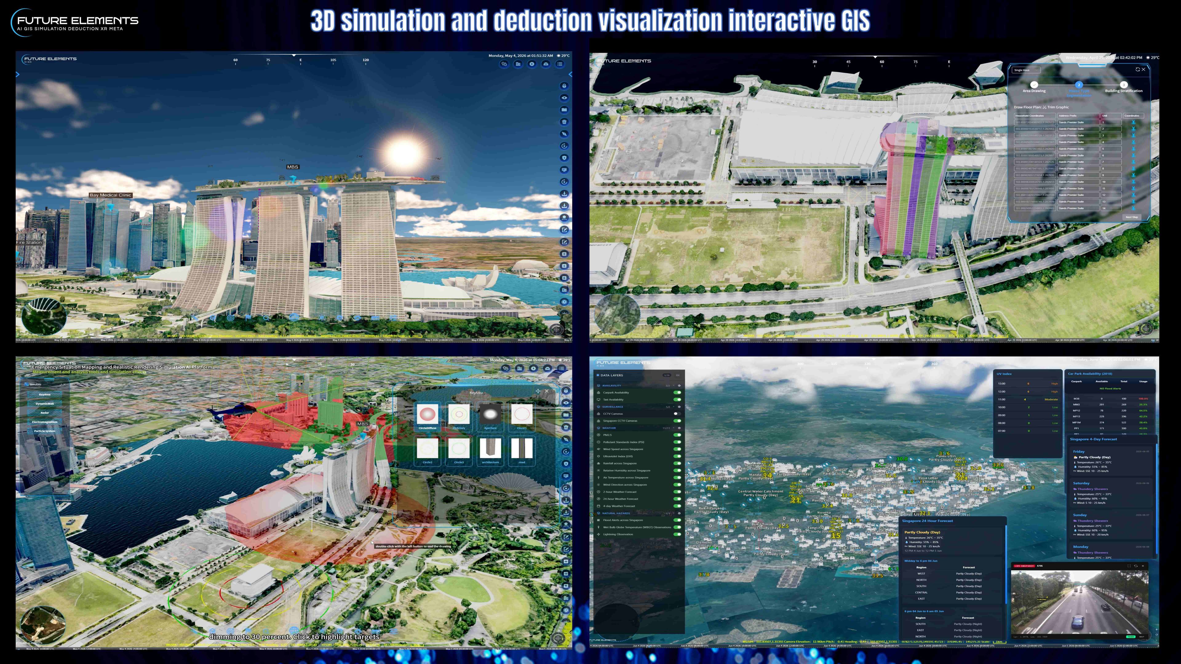
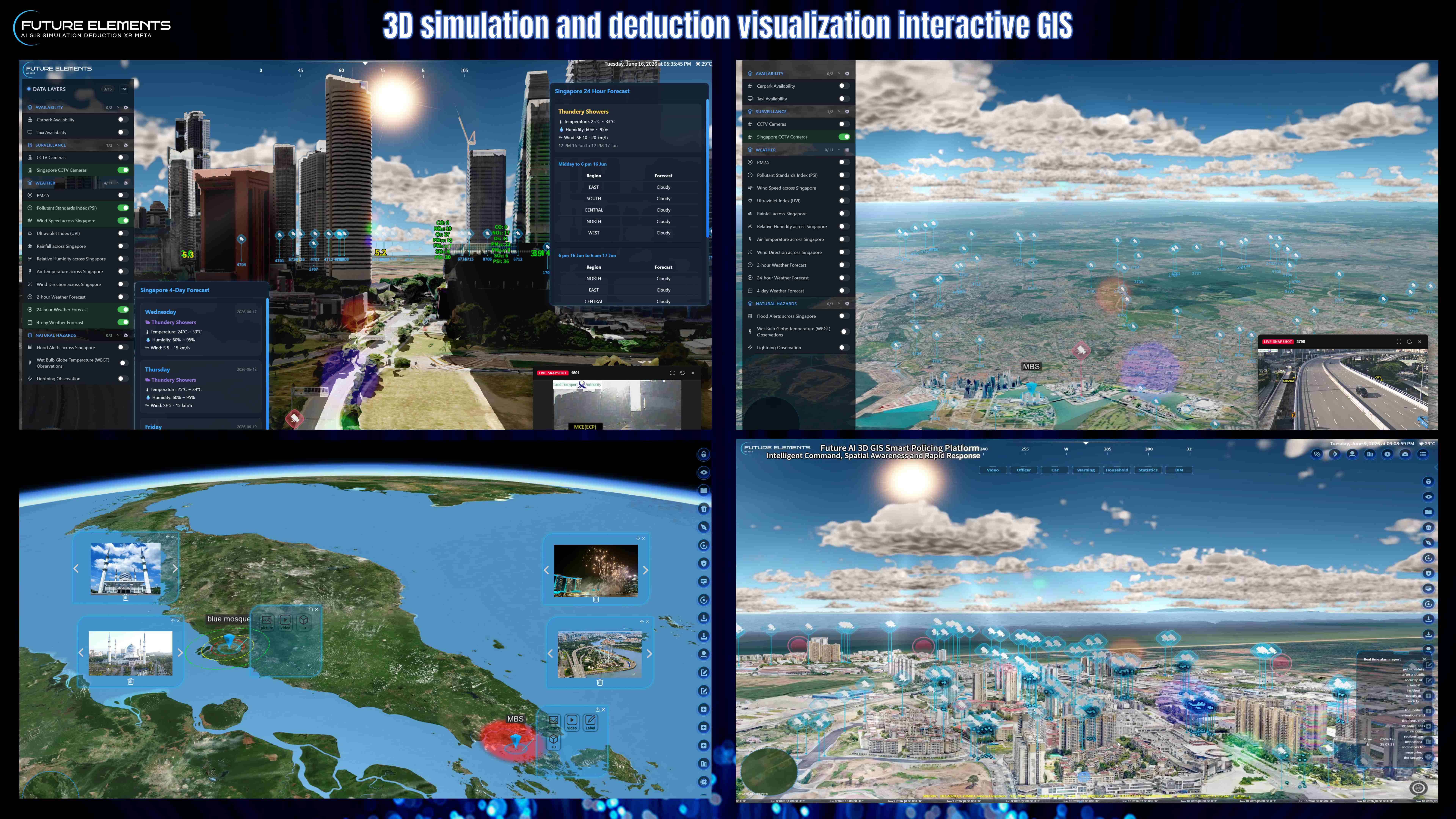
Discover how the FUTURE AI 3D GIS platform connects real time API data with a powerful 3D digital twin environment for smarter city monitoring and command centre operations.
In this demo, the platform showcases multi source data fusion, dynamic API parsing, and real time map visualization for Singapore and selected global data sources. With just a few clicks, users can access live operational insights directly on the 3D GIS map.
Key features demonstrated include:
SURVEILLANCE
View the latest static images from traffic cameras across Singapore and other parts of the world, displayed together with camera location information on the map. Images are refreshed automatically and are not real time video streams.
AVAILABILITY
Display islandwide Singapore parking availability by vehicle category, including cars, heavy vehicles, motorcycles with sidecars, and motorcycles. The same interface also supports real time taxi availability, showing available taxis as dynamic coordinate points on the map.
WEATHER
Visualize real time environmental data such as PM2.5, PSI, wind speed, UVI, rainfall, relative humidity, air temperature, wind direction, and weather forecasts. This data can also be linked with the FUTURE AI 3D GIS weather simulation system to render current weather conditions in 3D, including solar altitude, lighting, rainfall intensity, and lightning effects.
NATURAL HAZARDS
Monitor API based alerts and observations, including flood alerts, Wet Bulb Globe Temperature observations, and lightning observations across Singapore.
FUTURE AI 3D GIS transforms open data and real time APIs into a smart city command centre experience, helping agencies, facility operators, and urban planners improve situational awareness, emergency response, and data driven decision making.
Best suited for smart city operations, public safety, transport monitoring, digital twin platforms, emergency command centres, and GIS based urban management.