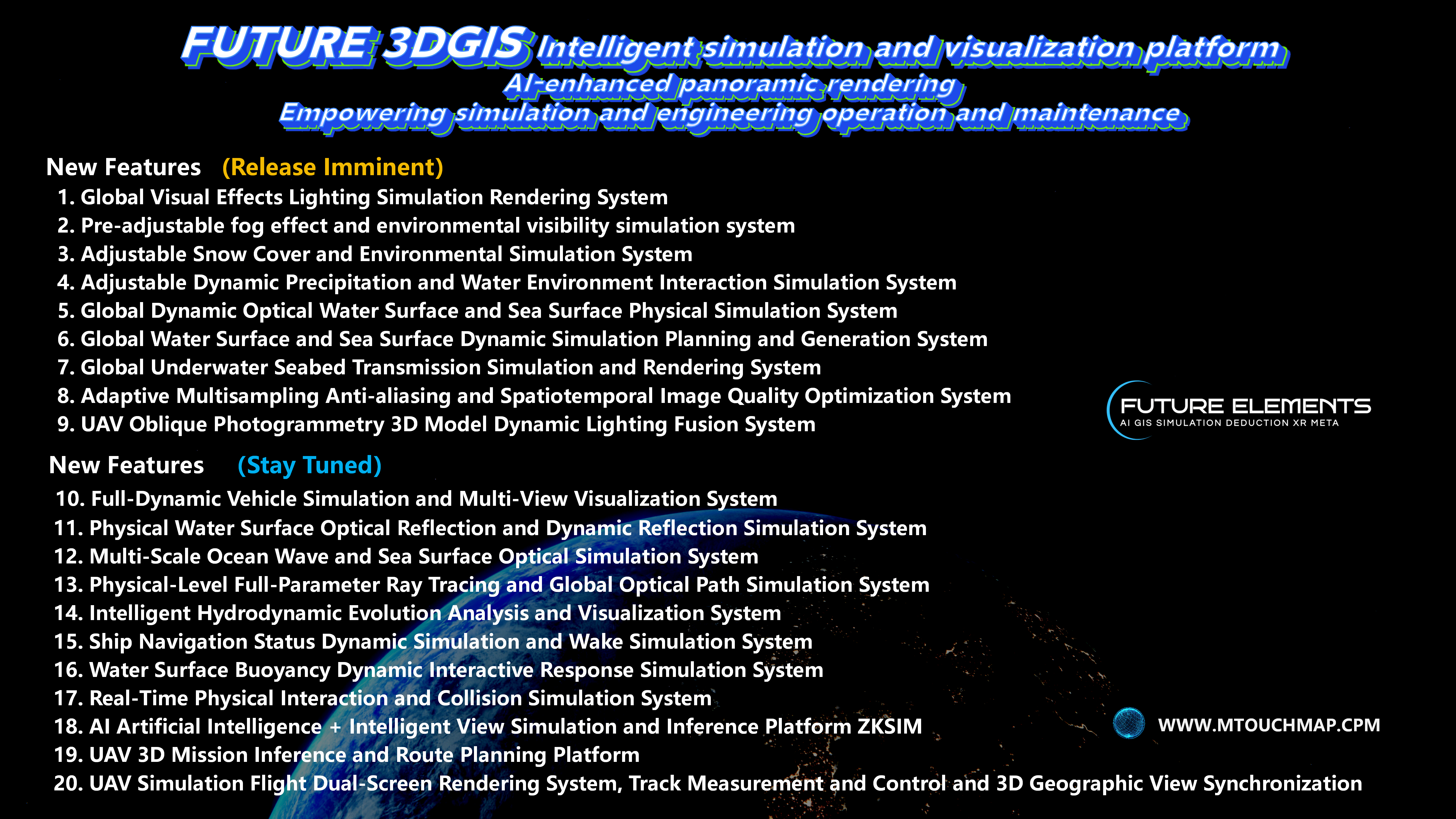
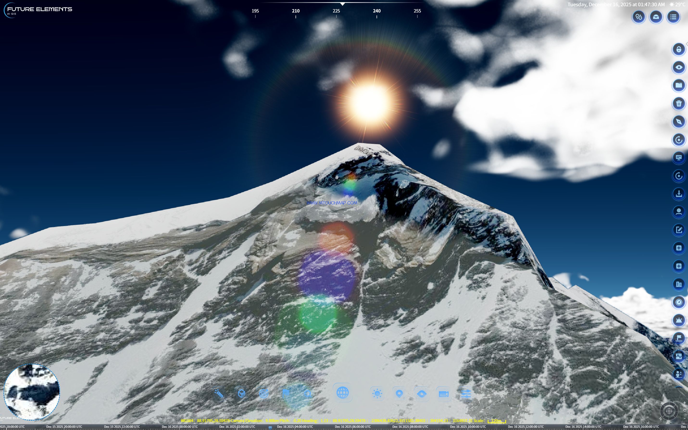
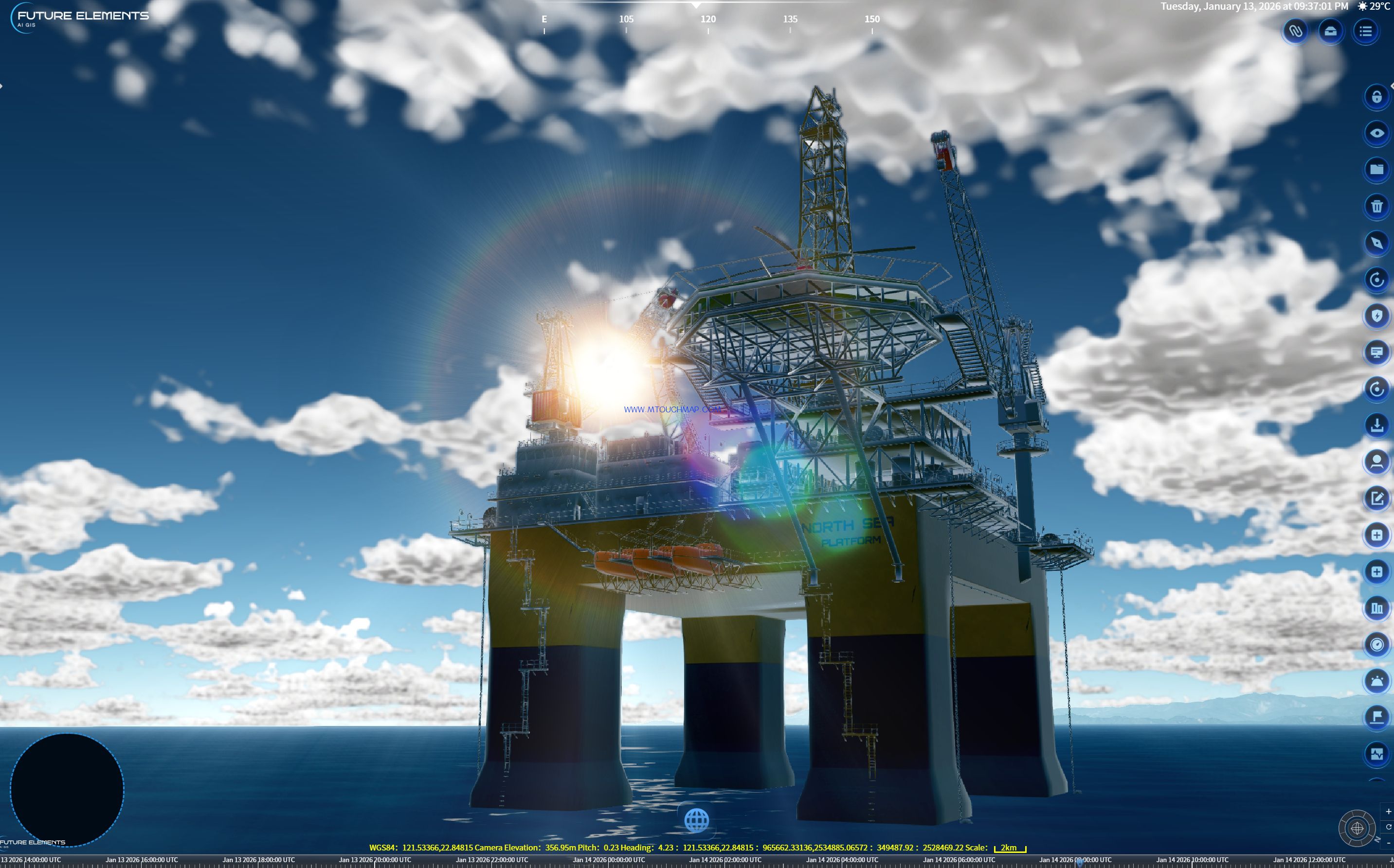
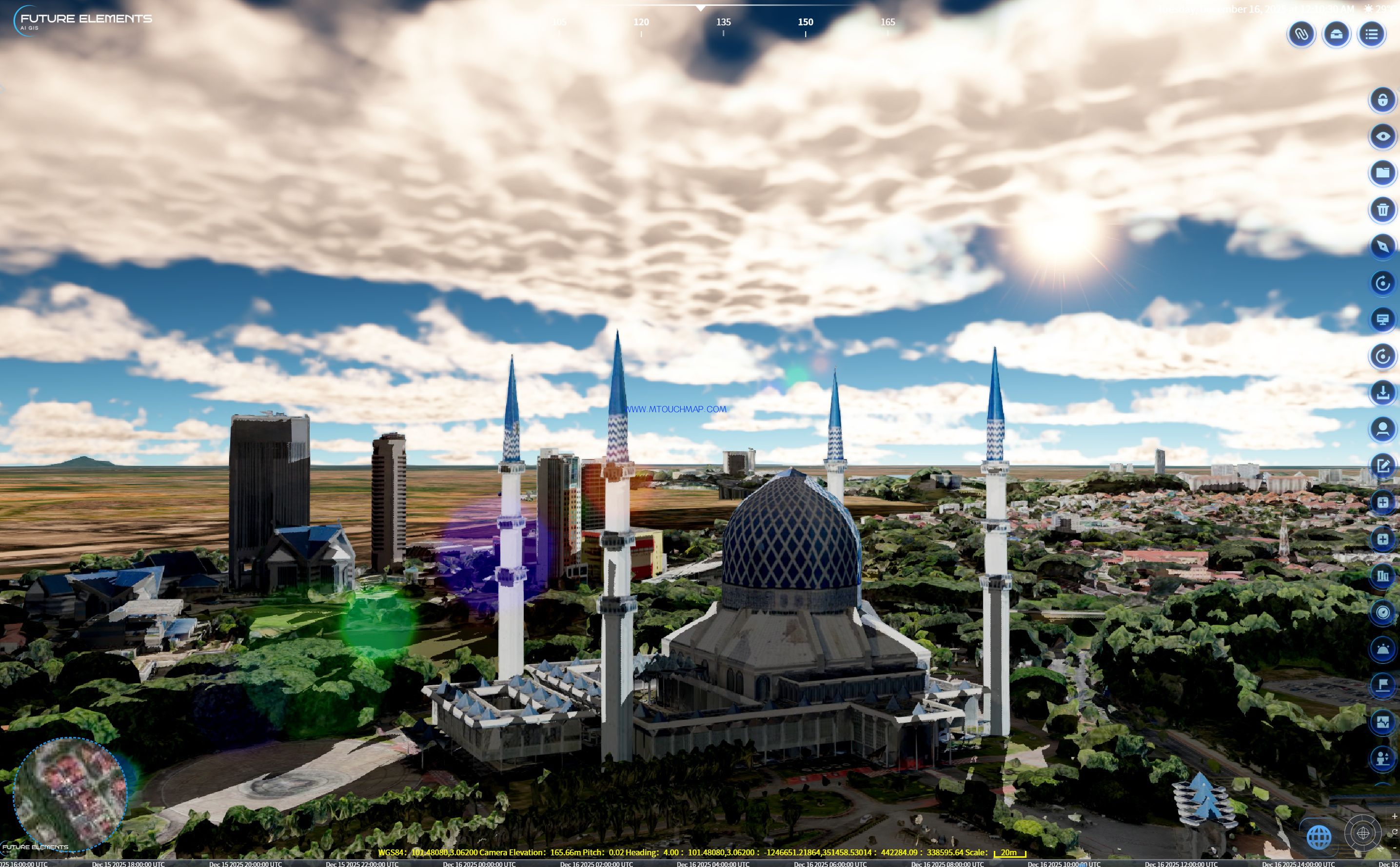
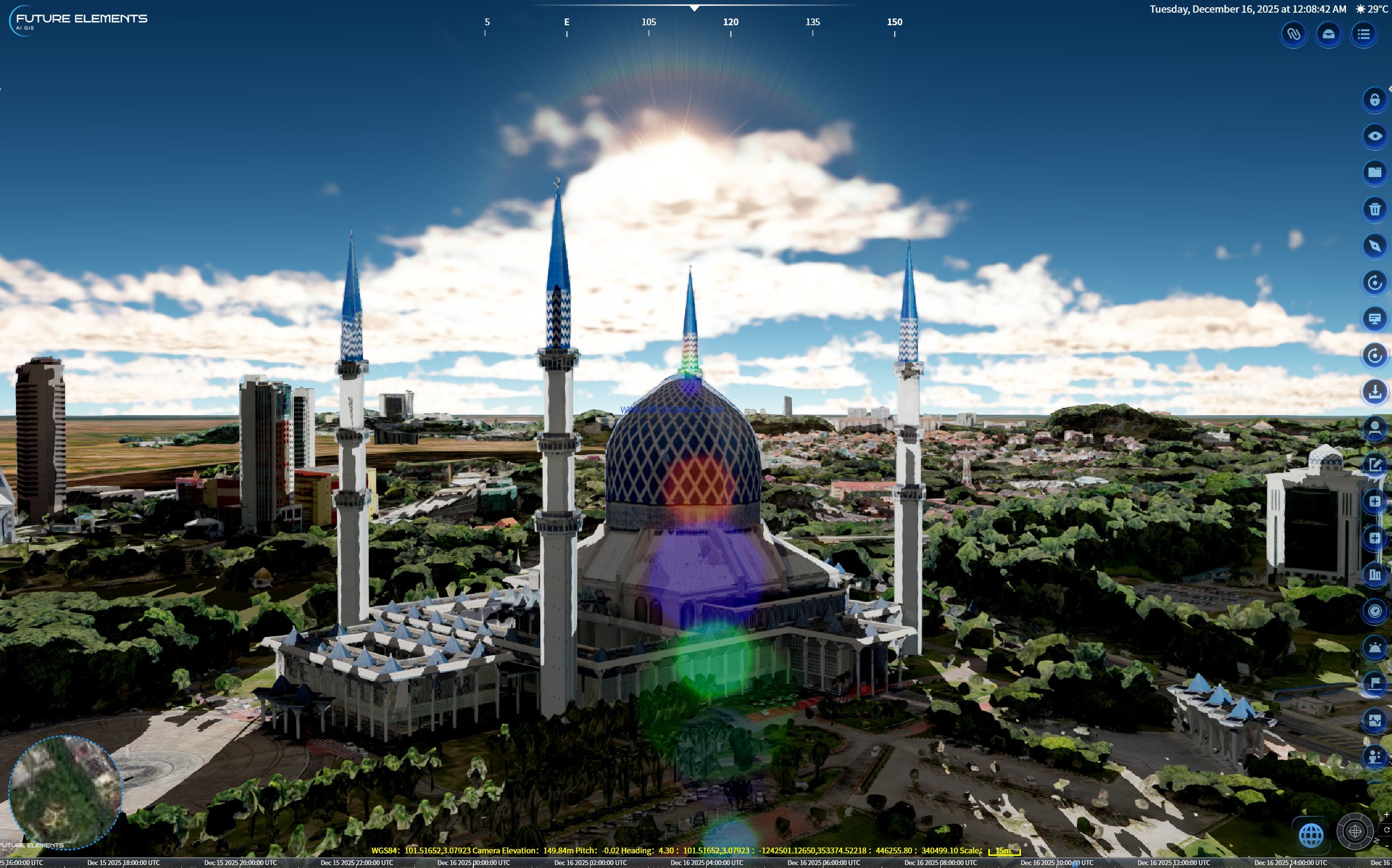
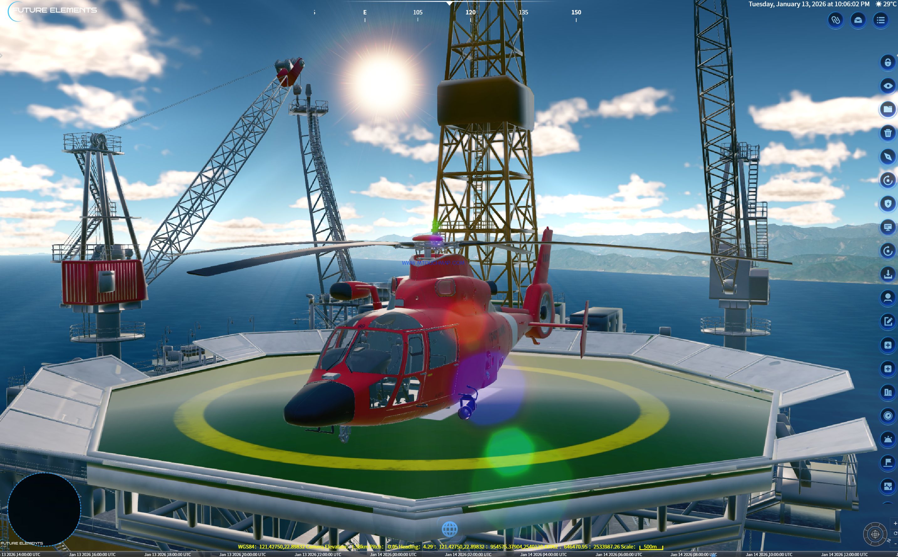
FUTURE 3DGIS is equipped with a fully parameterized global visual effects rendering system, a global underwater seabed transmission simulation rendering system, and a full dynamic vehicle simulation with multi-perspective visualization system.
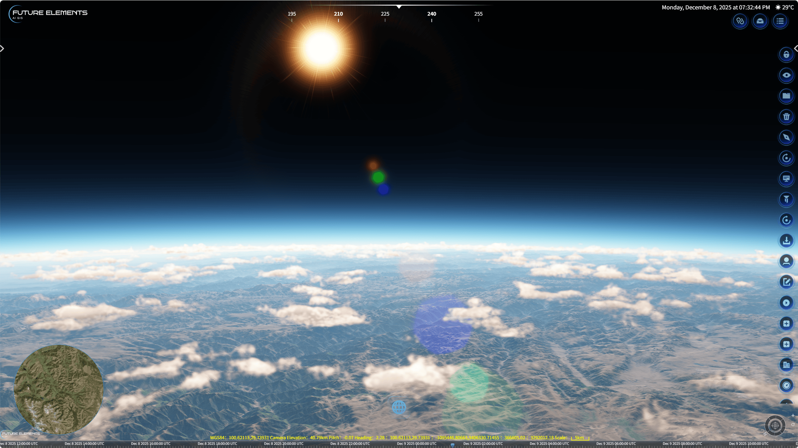
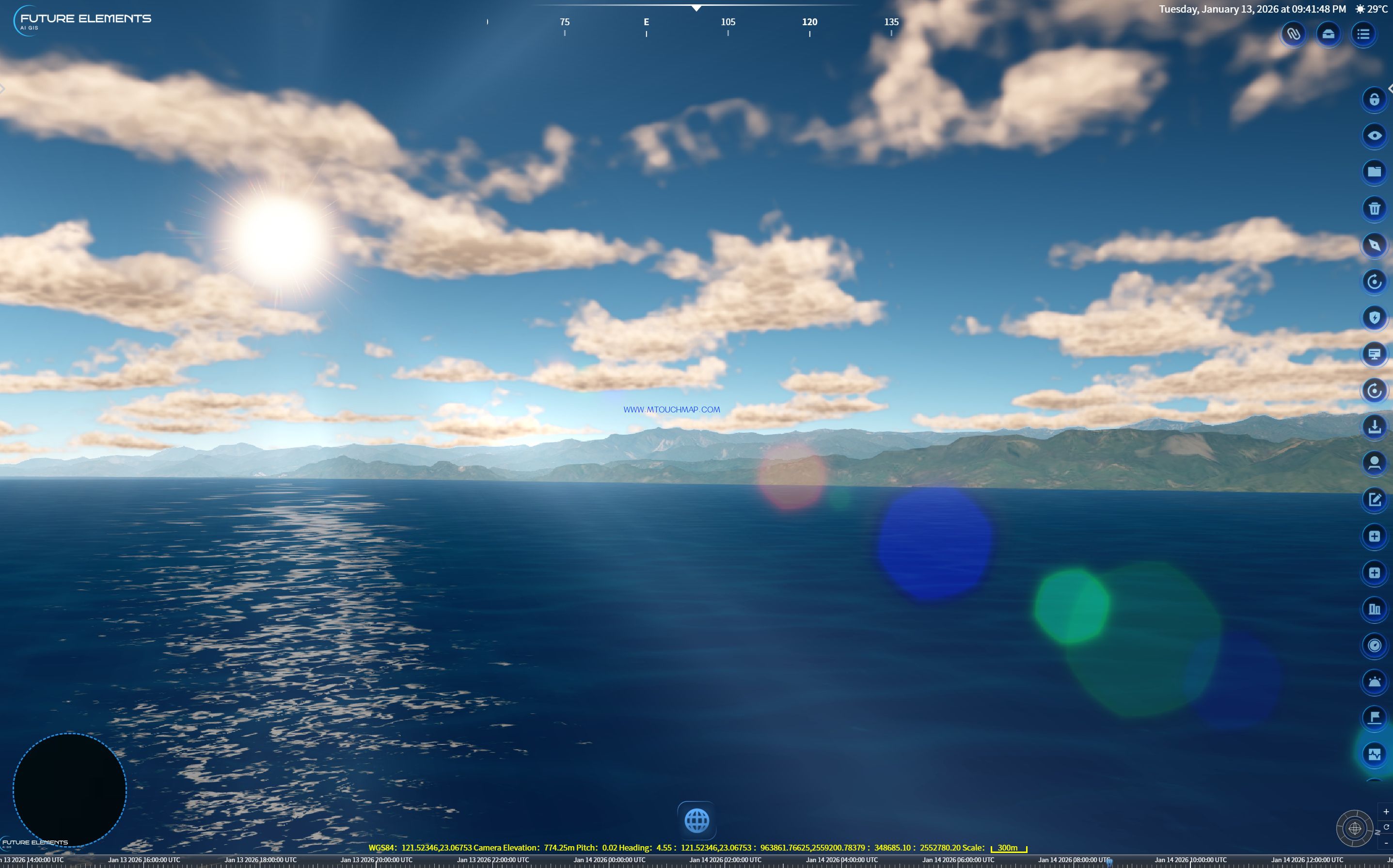
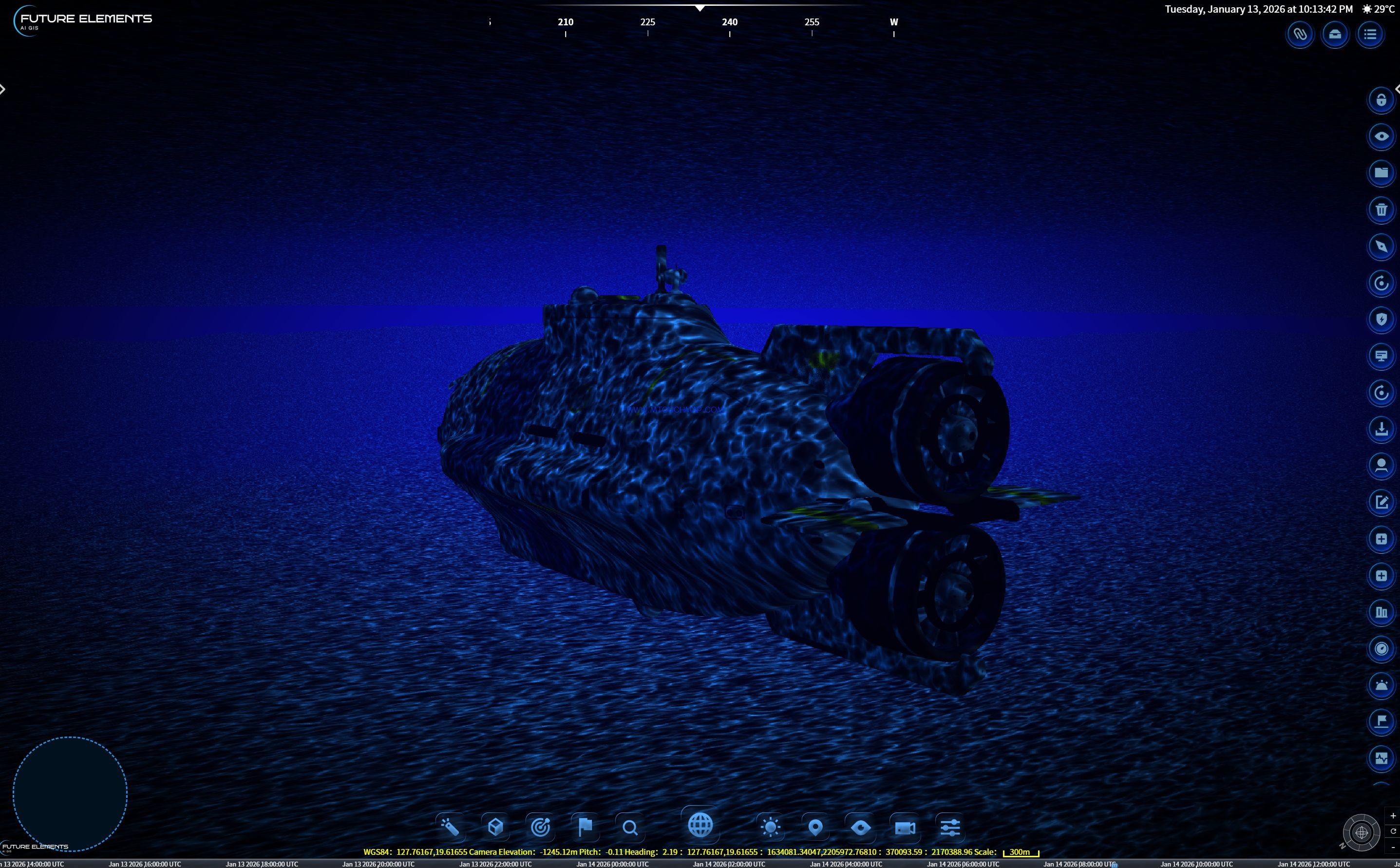
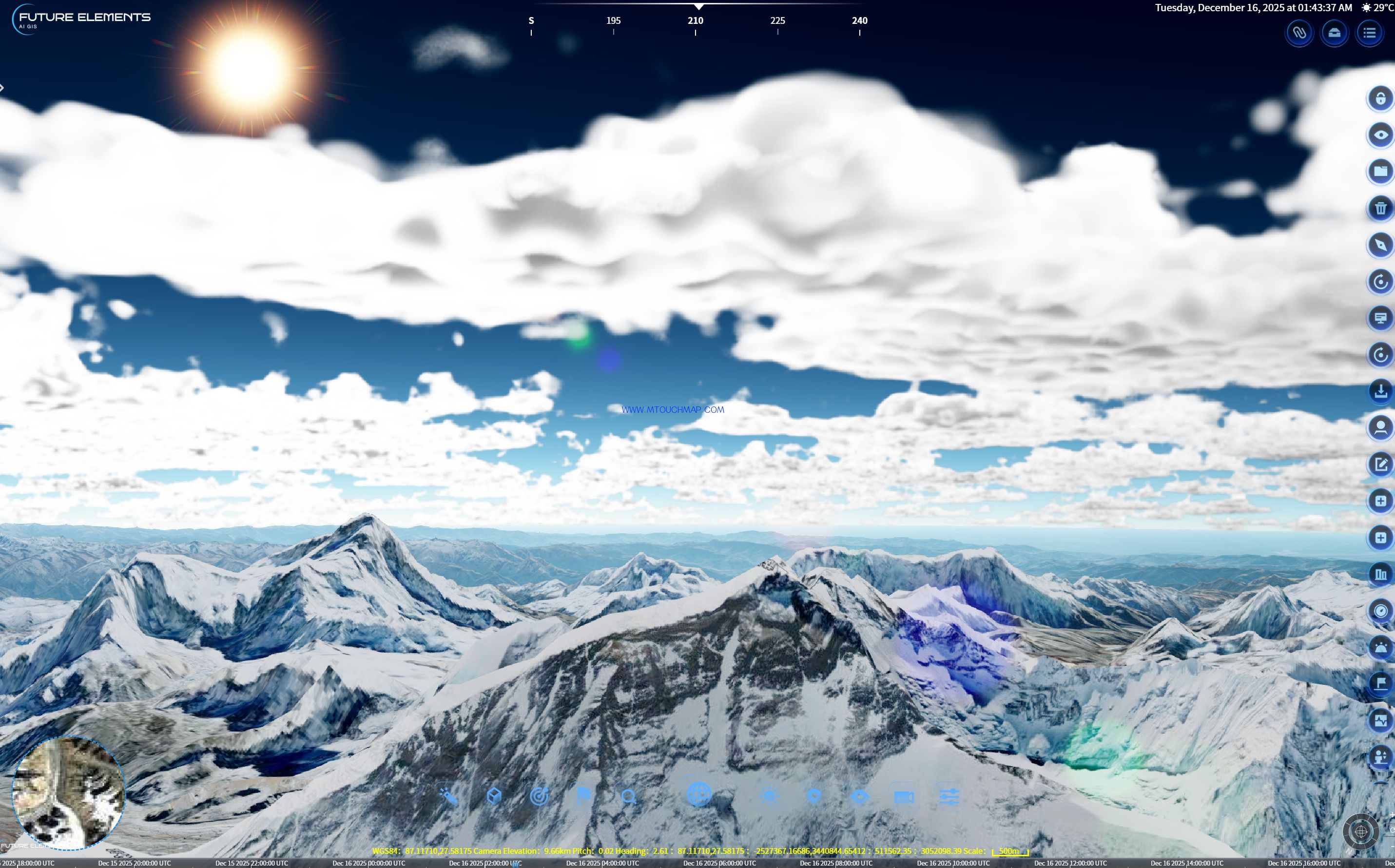
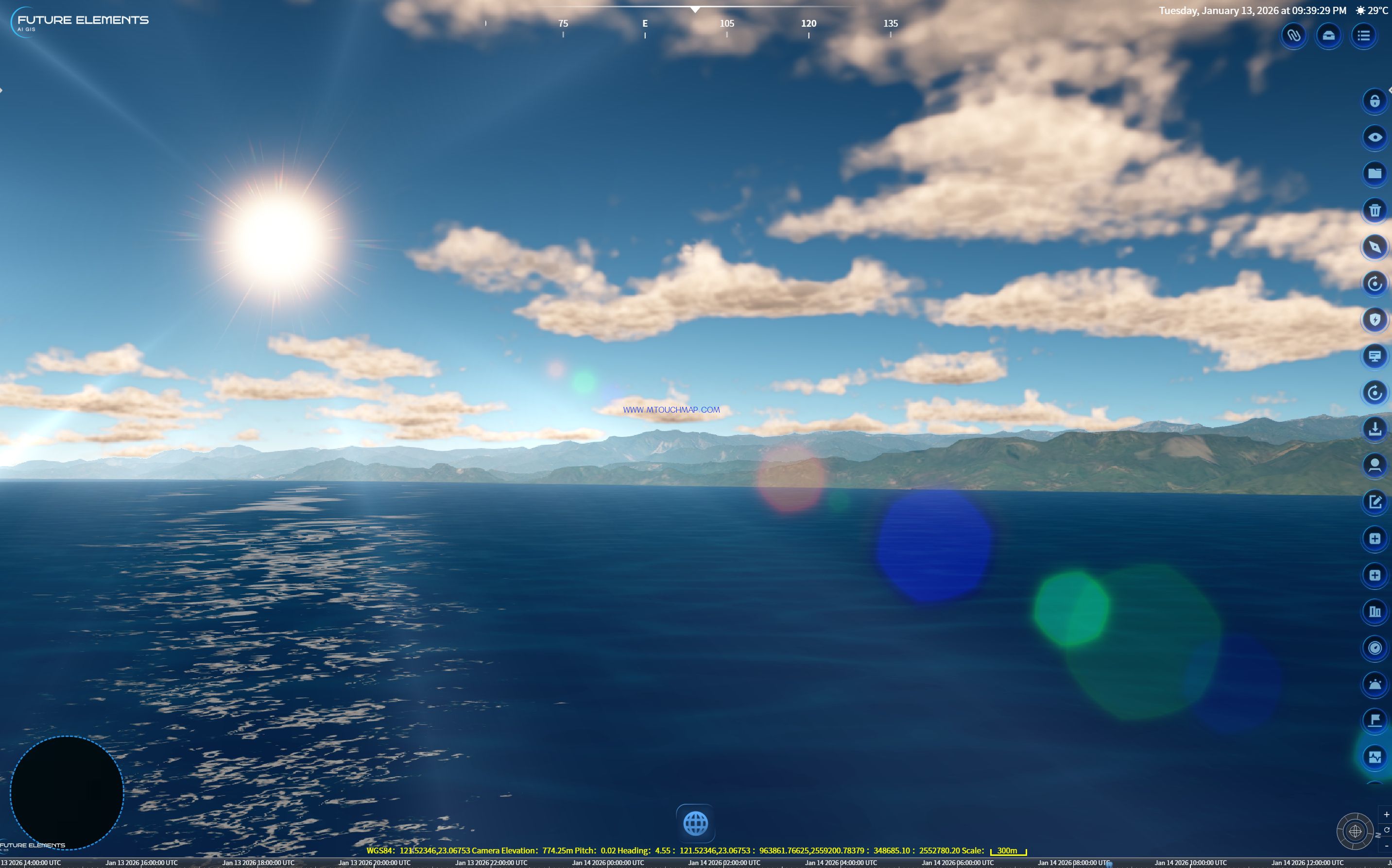
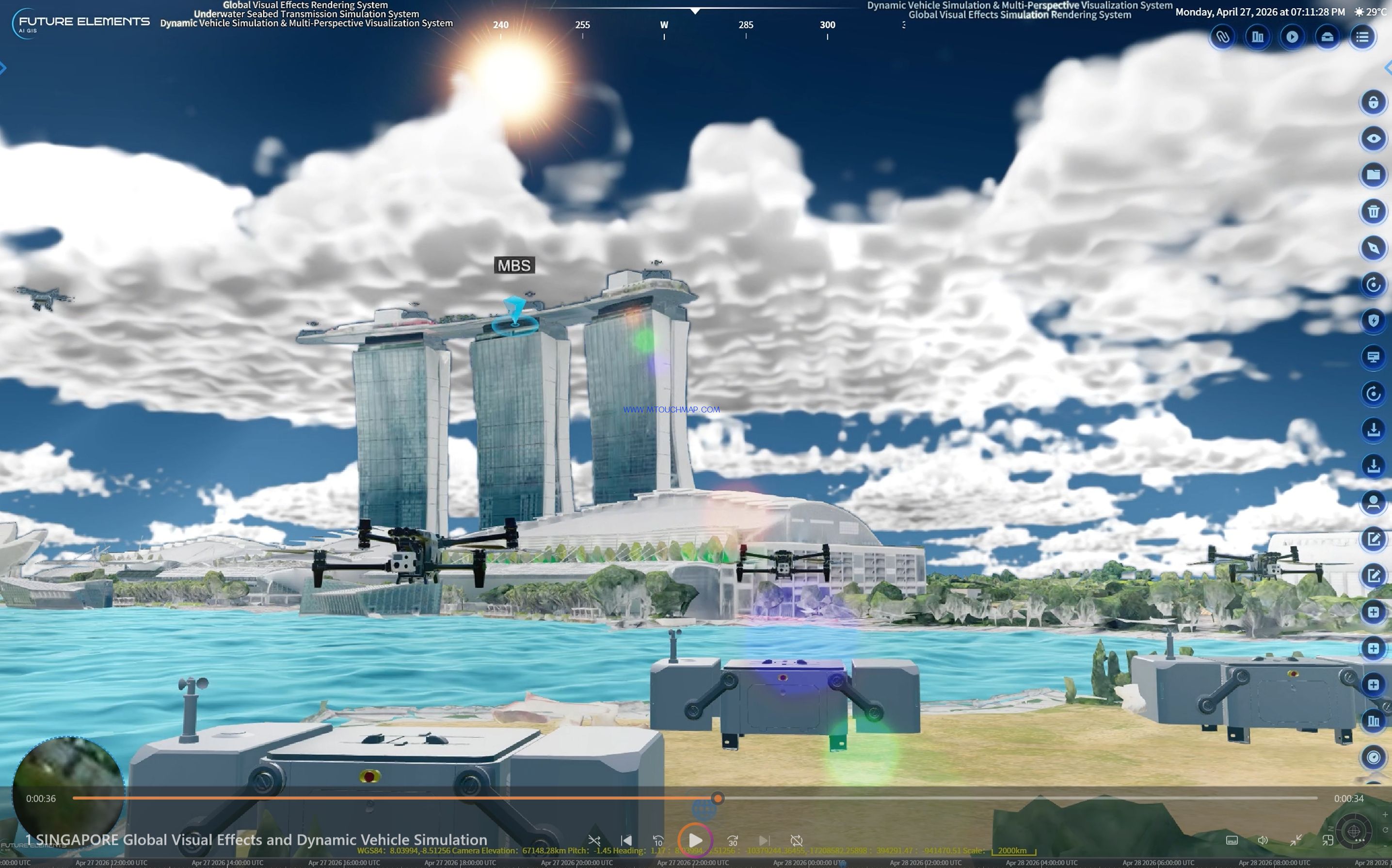
From the snowy peaks of Mount Everest, to the urban forest of Marina Bay Sands in Singapore, to the sea of clouds over Mount Kinabalu in Malaysia, and to the surface and depths of the Sulu Sea — all advanced rendering effects including glow, fog, volumetric light, ocean surfaces, and underwater scenes are freely combined and generated in real time within the same system, on a single platform.
One platform serves both civilian display and military simulation.
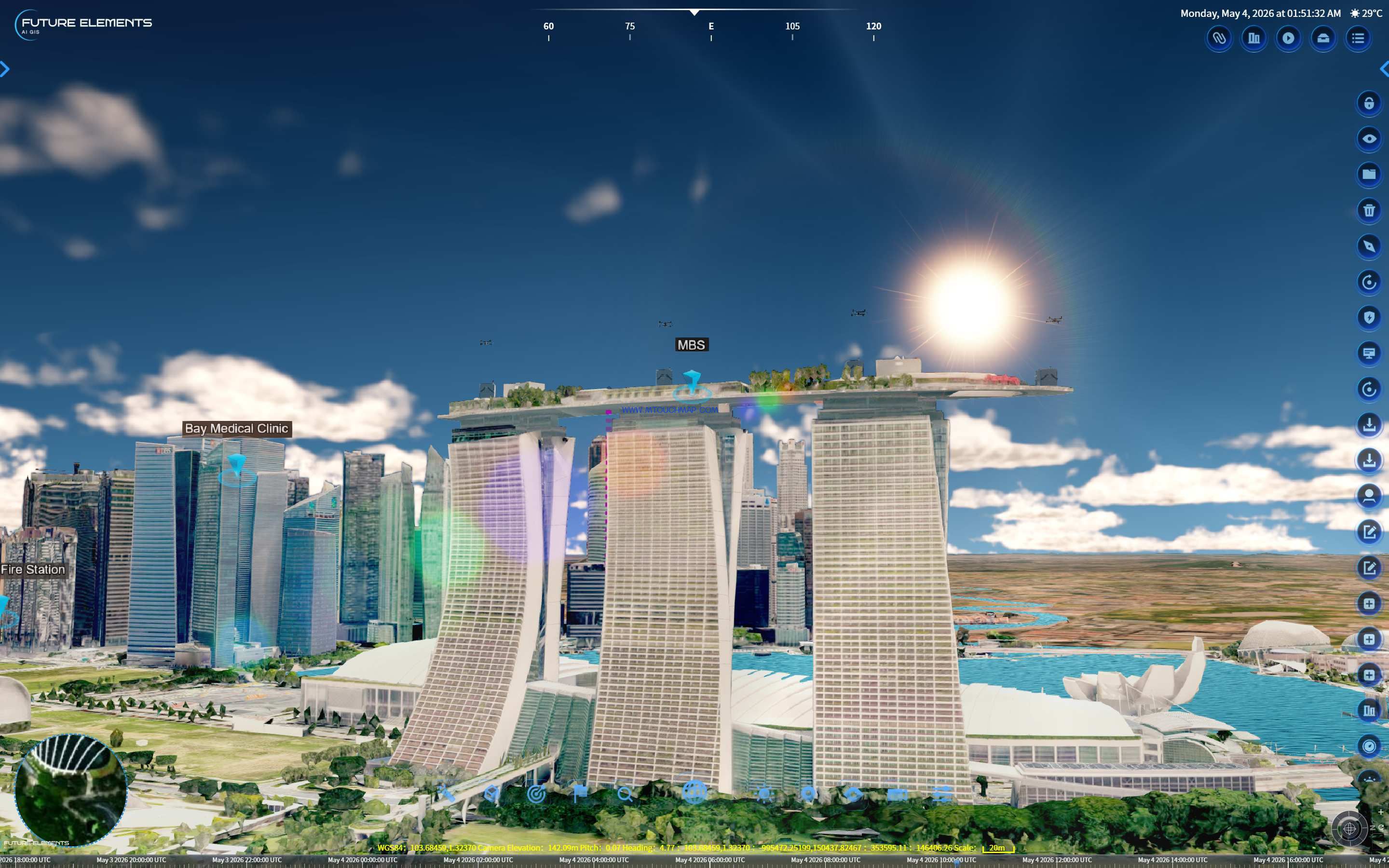
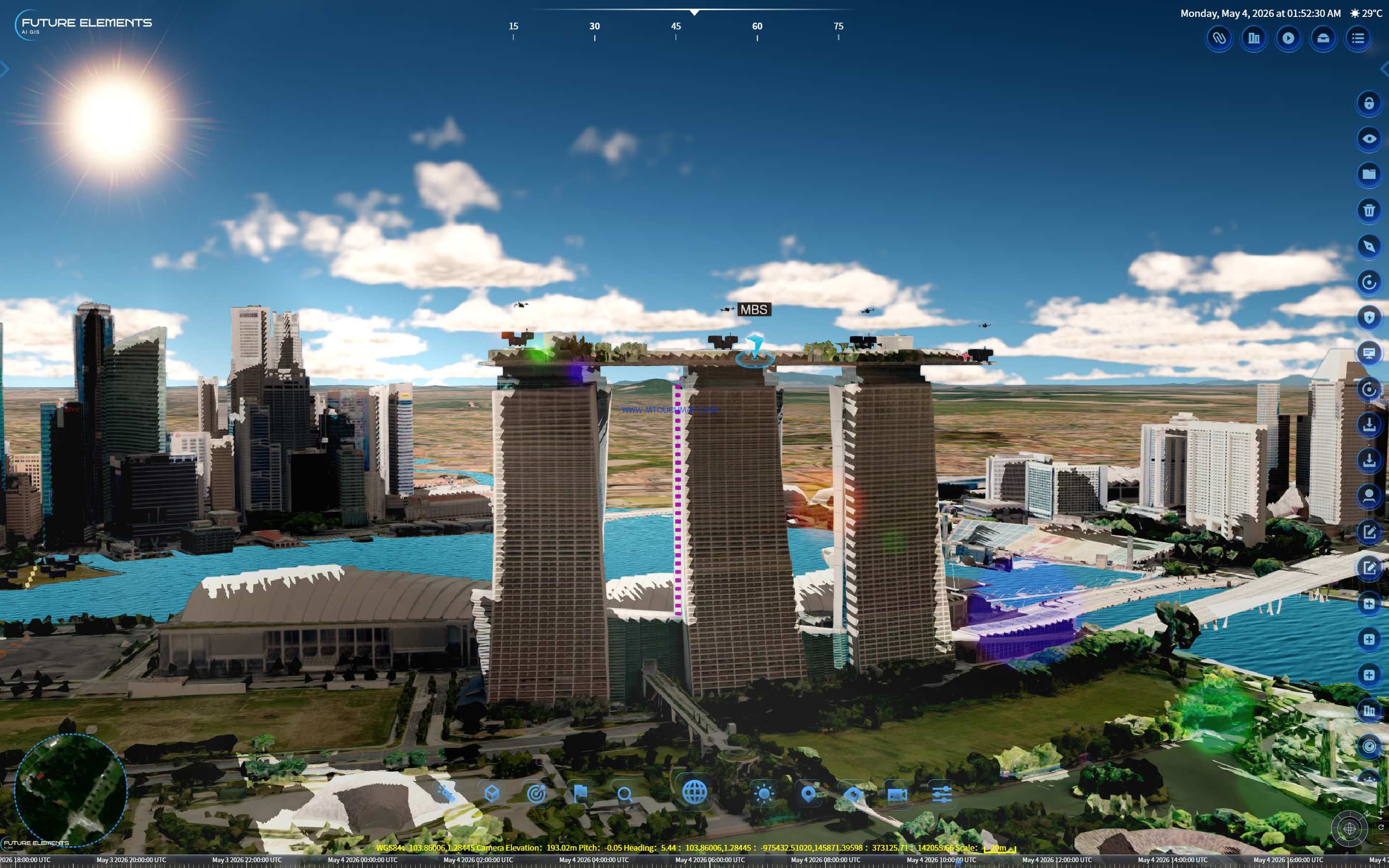
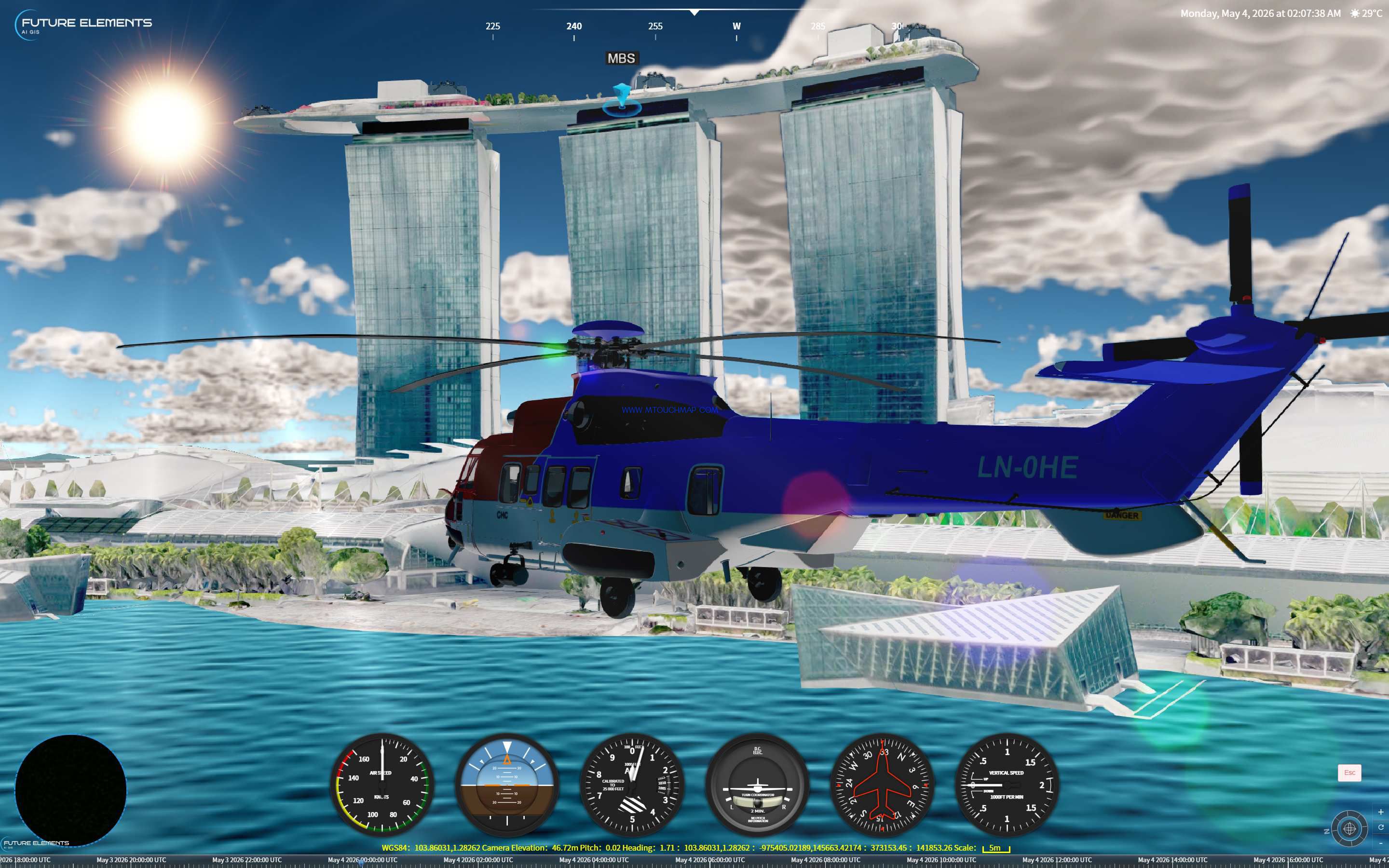
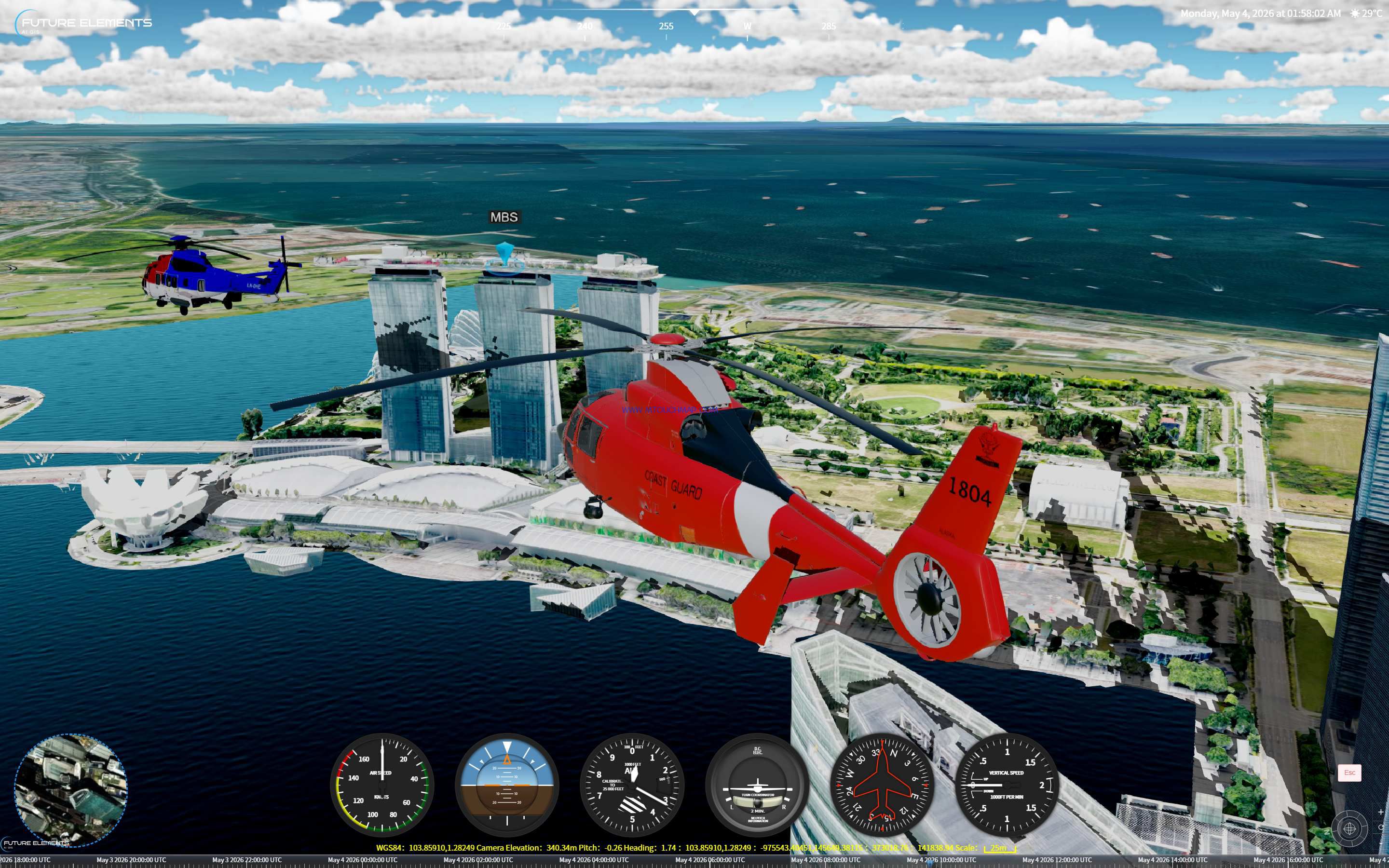
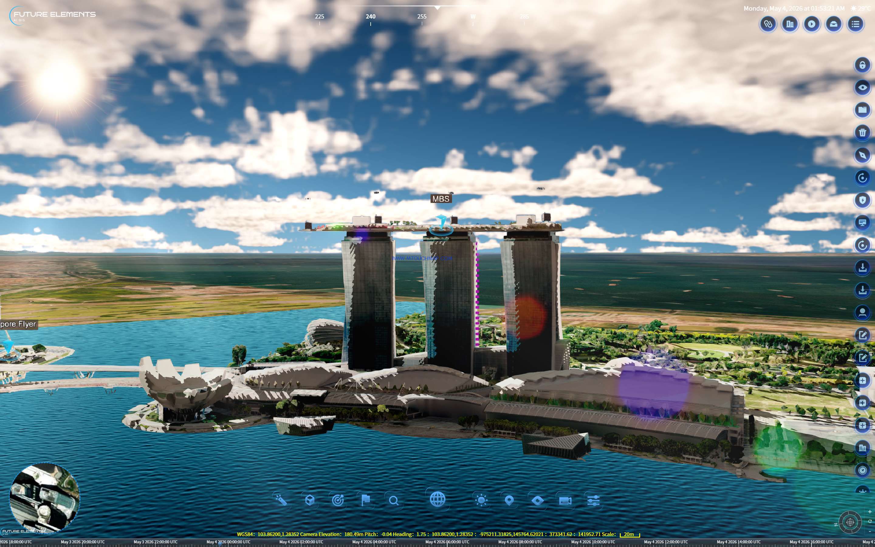
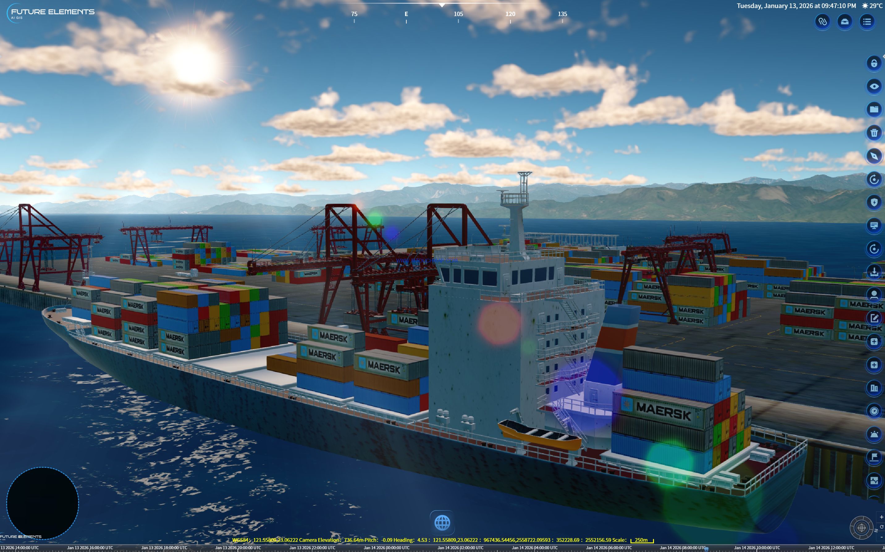
Using drone oblique photography data of Marina Bay Sands, with color filters and ray lens flare applied, the system fully captures the urban light and shadow of Singapore's "24 hours". Geometric level rendering keeps every building sharp under dynamic lighting — providing a high-precision 3D foundation for smart city demonstrations, urban planning, as well as urban combat simulation and target reconnaissance.
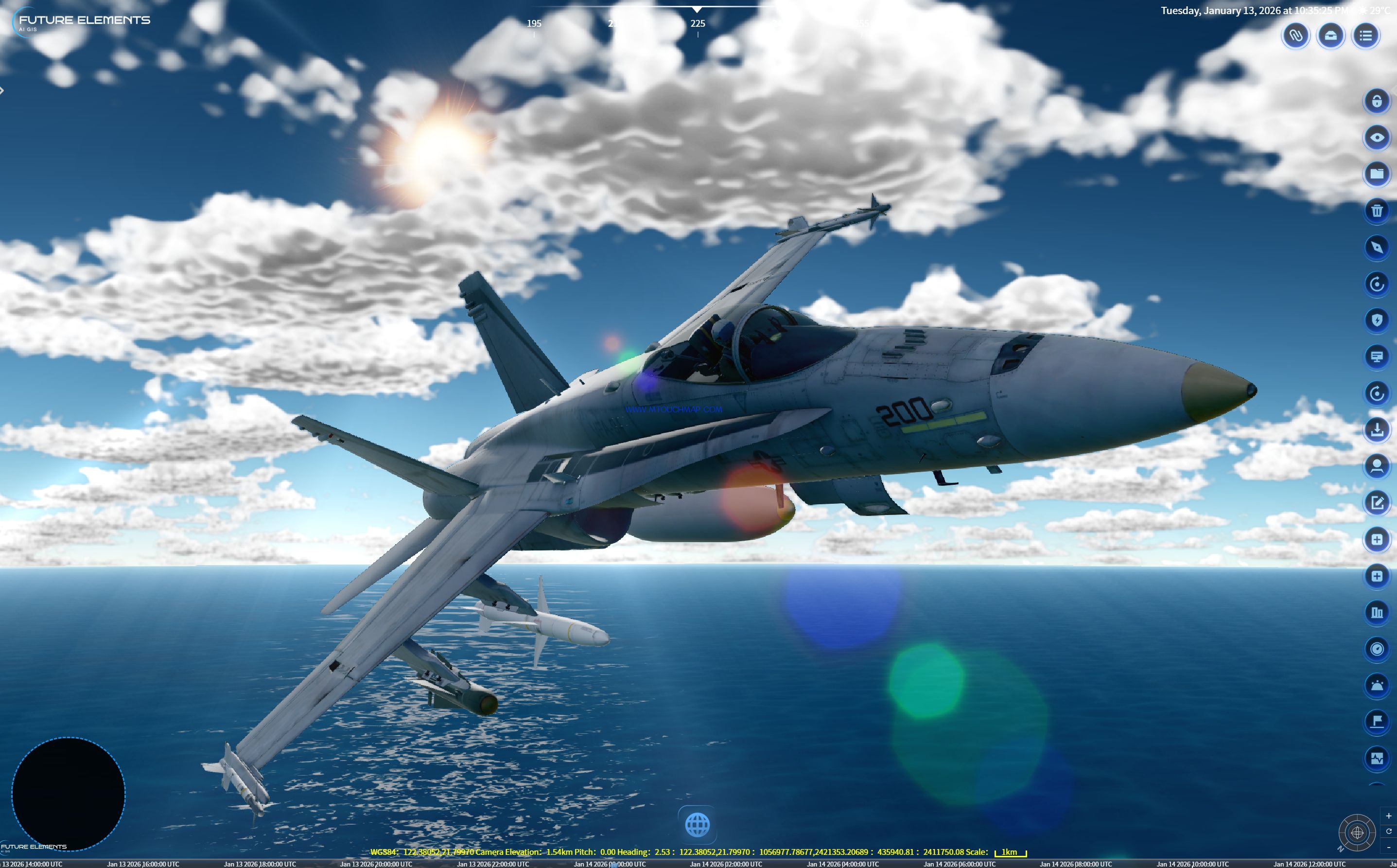
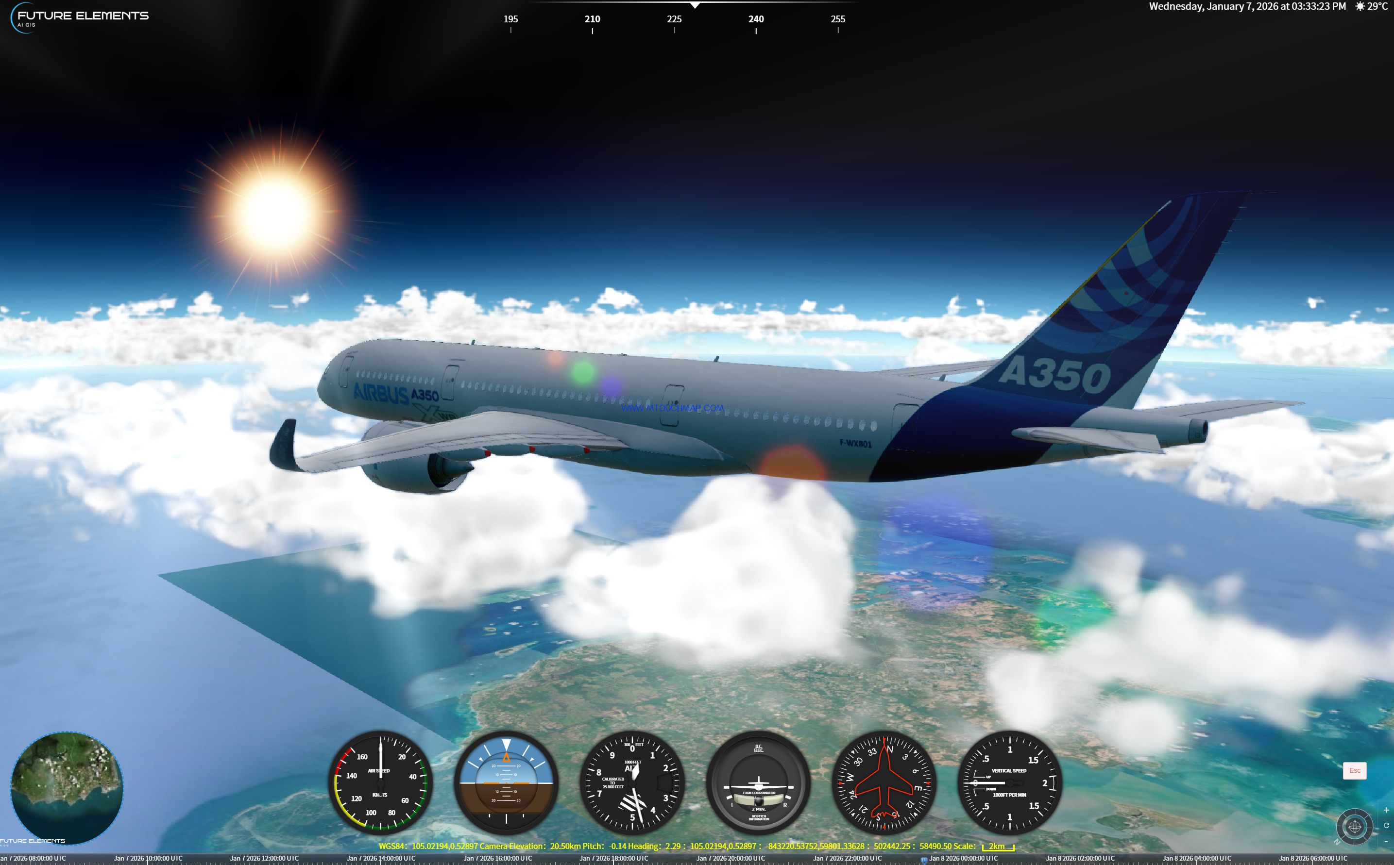
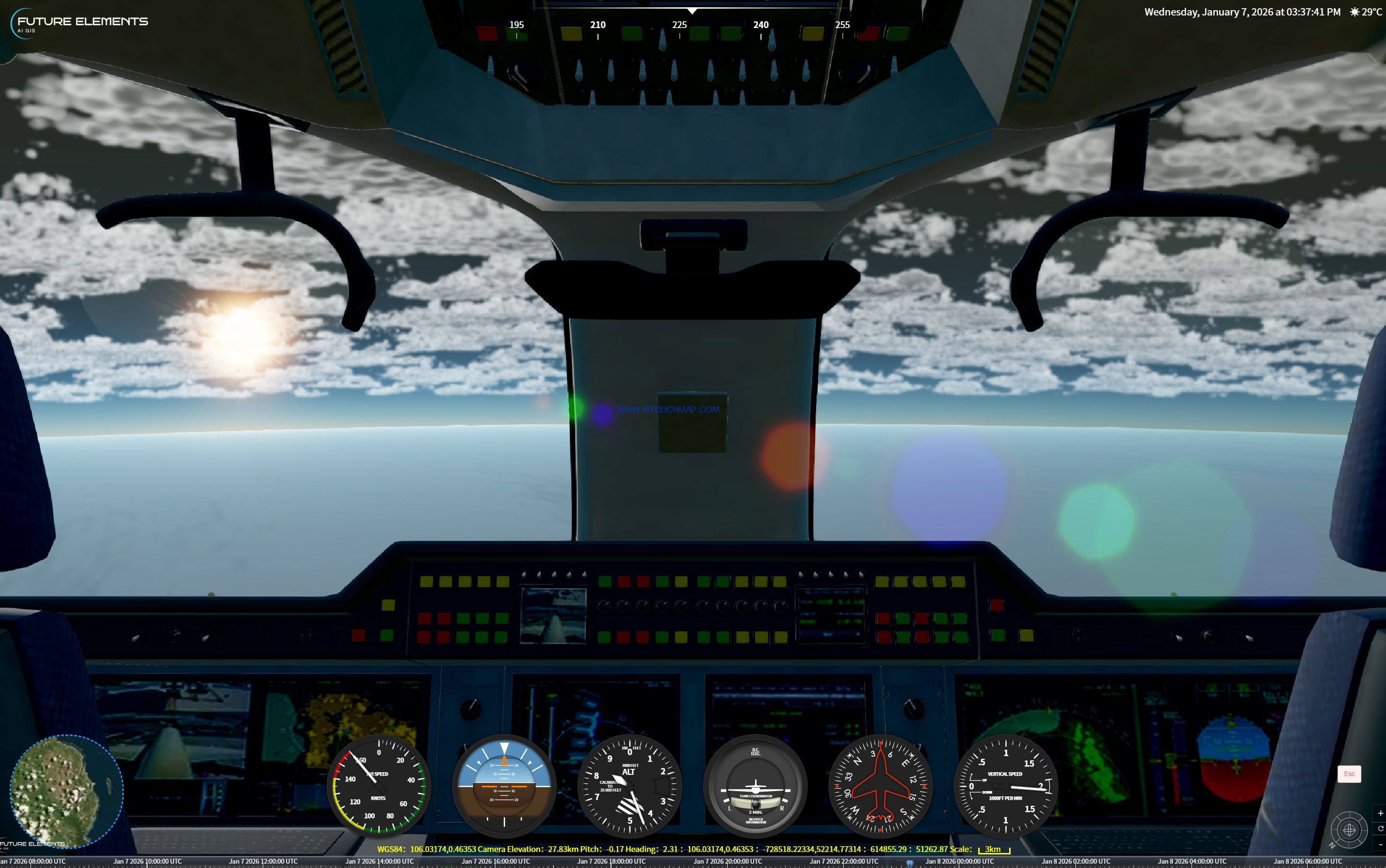
Integrated with the full dynamic vehicle simulation and multi-perspective visualization system, key parameters such as longitude, latitude, attitude, and speed of the vehicle are rendered in real time. The system supports keyboard (WASDQE) control for acceleration, steering, and climbing, and allows free switching between first-person, third-person, and free perspectives. A high-fidelity virtual dashboard is simultaneously generated, displaying core data including speed, heading, altitude, and more.
1. Global Visual Effects Lighting Simulation Rendering System: Allows for arbitrary parameter adjustment to various advanced rendering effects such as glow/flood/atmosphere/fog/volume clouds/volume lighting/color filters/ray lens flare/horizontal environmental occlusion/geometric subdivision. This visual effects simulation rendering system, through precise control of all parameters, provides you with highly realistic and expressive 3D scene visual effects that meet the needs of both military simulations (such as battlefield environment construction, reconnaissance and camouflage analysis) and civilian demonstrations (such as smart city demonstrations, geological and terrain simulations), achieving accurate rendering and flexible customization from natural phenomena to professional atmospheres.
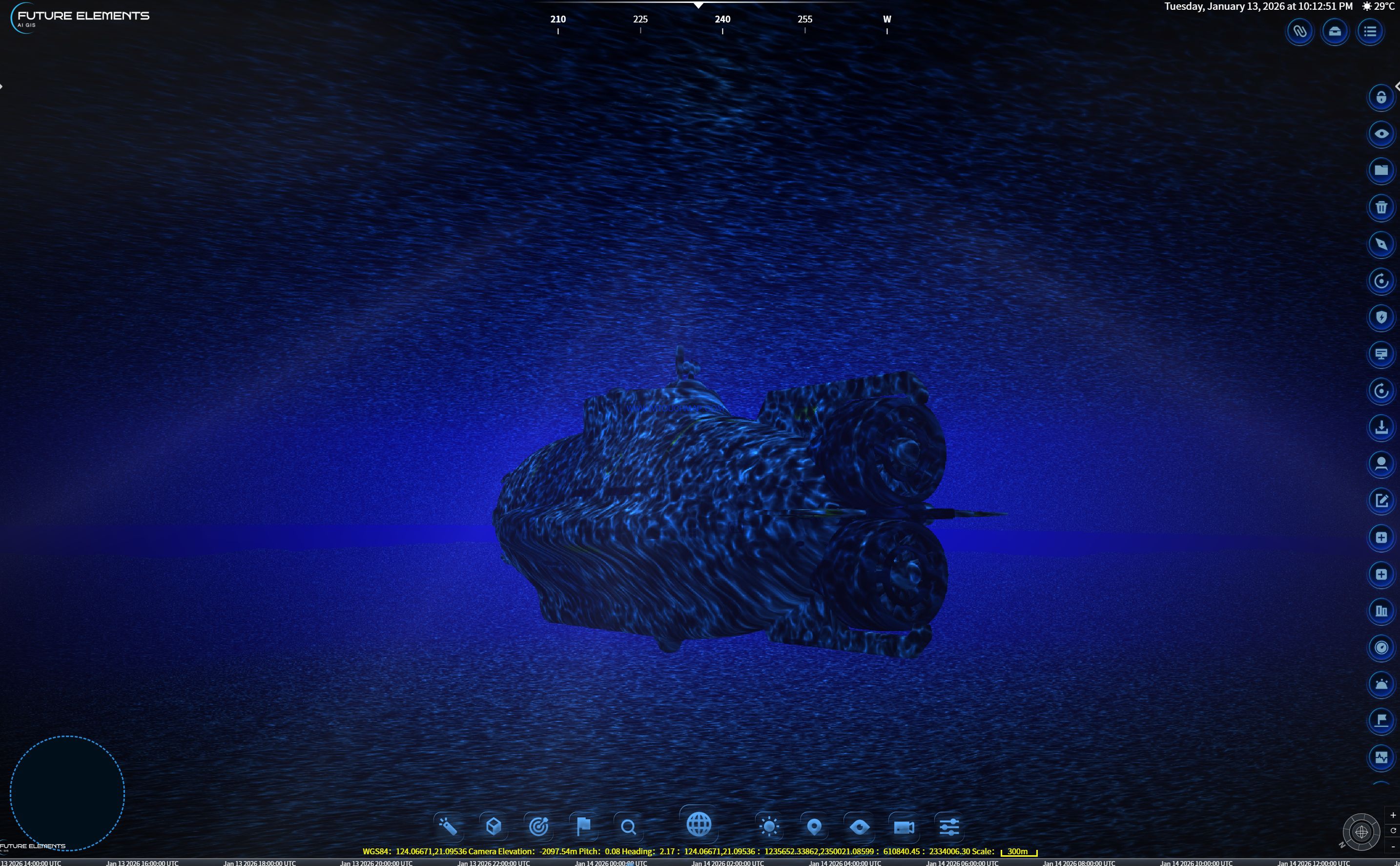
2. Global Underwater Transmission Simulation Rendering System (Underwater Rendering System): Allows for arbitrary parameter adjustment to water color, center, repetition, and fog attenuation. By precisely controlling water color, center position, pattern repetition, and underwater fog attenuation, and combining it with global visual effects lighting simulation rendering functions to simulate the realistic optical effects of sunlight penetrating the water surface, this function can highly simulate various underwater lighting environments, effectively supporting the 3D visualization needs of military underwater reconnaissance and civilian marine engineering fields.
3. Fully Dynamic Vehicle Simulation and Multi-View Visualization System: Real-time rendering of key parameters such as latitude, longitude, attitude, and speed of the vehicle, seamlessly linked with global visual effects and lighting simulation to present realistic all-weather lighting effects. Supports keyboard (WASDQE) control for acceleration, steering, and climbing, with free switching between first/third/free viewpoints. Synchronously generates a high-fidelity virtual dashboard, mapping core data such as speed, heading, and altitude. Features shooting simulation, combined with gravity and air resistance physics calculations. Provides a highly immersive visualization platform for military tactical training, equipment performance uation, and civilian vehicle simulation.